


Overview
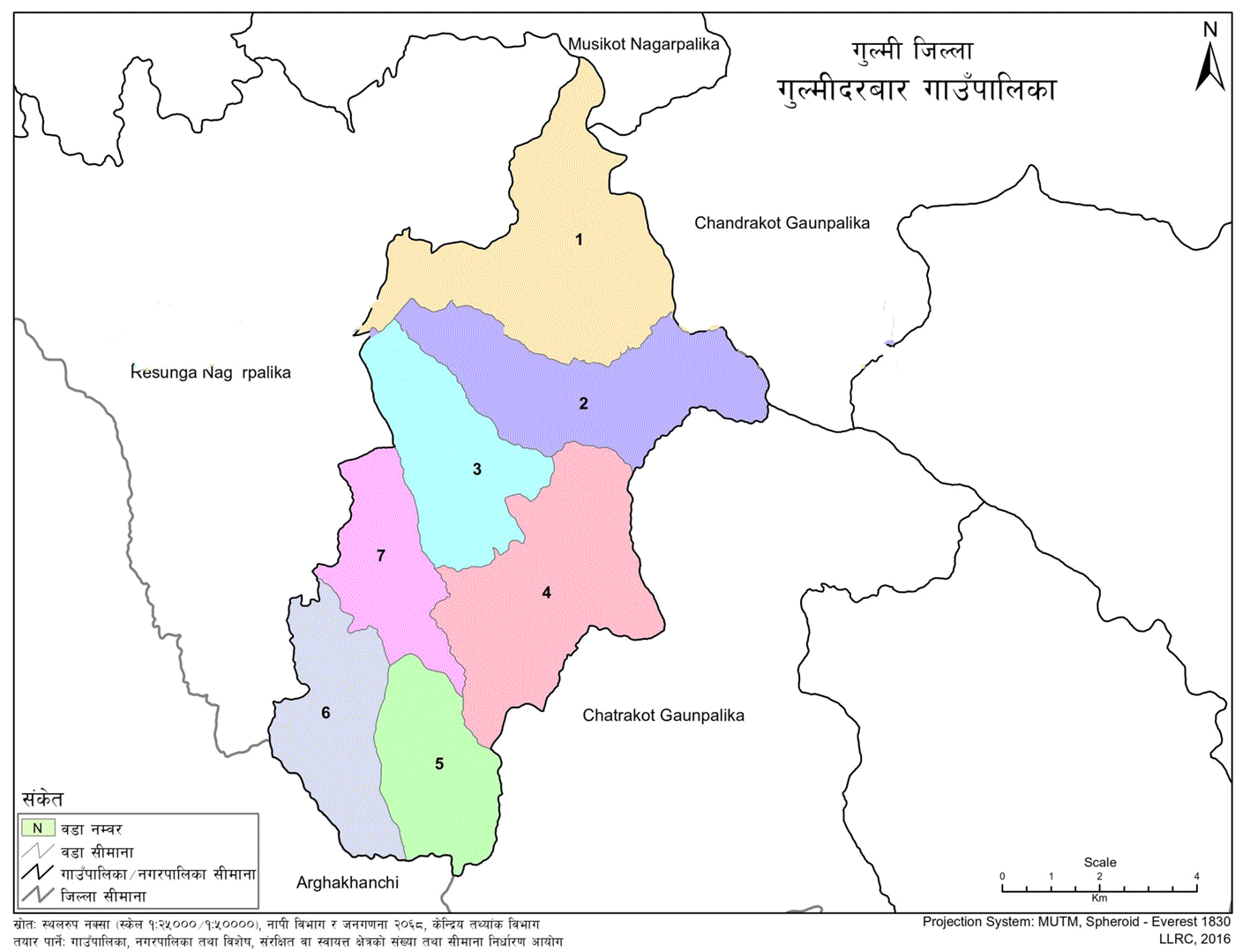
Gulmidarbar Rural Municipality is one of the local levels established under Article 295 of the Constitution of Nepal. Known for its historical, religious, cultural, and geographical significance, Gulmidarbar lies within Gulmi District under Lumbini Province. It was formed by merging the former Village Development Committees of Balithum, Jubhung, Gaundakot, Birbas, Amararbathok, and Darbar Devisthan.
Previously, the Darbar Devisthan VDC was divided into two wards. Today, the municipality comprises seven ward offices. Gulmidarbar covers an area of 79.99 square kilometers and has a population of 19,296. The administrative center is located in Gaundakot.
The municipality is bordered as follows:
-
East: Chhatrakot and Chandrakot Rural Municipalities
-
West: Resunga Municipality
-
North: Chandrakot Rural Municipality and Musikot Municipality
-
South: Chhatrakot Rural Municipality and Arghakhanchi District
Brief Introduction of the Rural Municipality
-
On 2073/11/27 B.S., Gulmidarbar Rural Municipality was established under Nepal’s political restructuring into local levels.
-
Among the 753 local governments, Gulmidarbar stands out for its unique identity rooted in history, culture, and geography within Gulmi District.
-
Previously part of the Western Development Region and Lumbini Zone, Gulmidarbar is one of 12 local levels in Gulmi District. It was formed by amalgamating 6 former VDCs: Balithum, Jubhung, Gaundakot, Birbas, Amararbathok, and Darbar Devisthan.
-
The Rudrawati River flanks it to the east, Bathowa Khola and Keduwa Khola to the west, Resunga to the north, and Bakhrekhola to the south.
-
According to the 2021 National Census, the municipality spans 79.99 square kilometers and has a total population of 19,296.
Political Division and Boundaries of Gulmidarbar Rural Municipality
- Province: Lumbini
- District: Gulmi
- Municipal Office: Gaudakot
- Number of Wards: 7
- Municipality Center: Gaudakot
Geographic Structure and Borders
-
Area: 79.99 square kilometers
-
East: Chhatrakot and Chandrakot Rural Municipalities
-
West: Resunga Municipality
-
North: Chandrakot Rural Municipality and Musikot Municipality
-
South: Chhatrakot Rural Municipality and Chhatradev Rural Municipality of Arghakhanchi District

.jpg)


