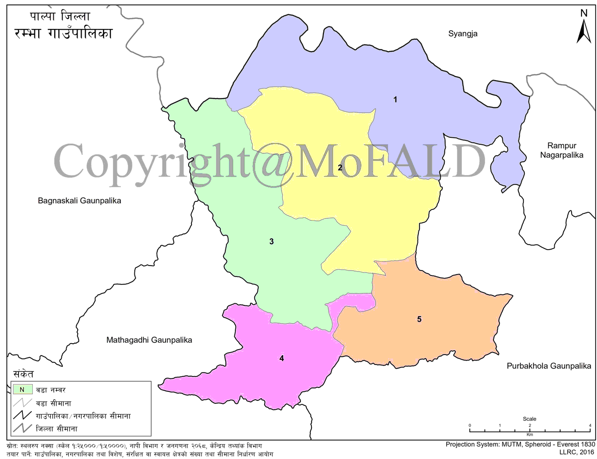

Overview
Rambha Rural Municipality (Rambha Gaupalika - रम्भा गाउँपालिका) was formed after the declaration of local levels by the Nepal government on 27 Falgun 2073 by merging 5 previous VDCs (Ward No. 9 of Hungi VDC, Phoxingkot VDC, Pipaldanda VDC, Humin VDC, Tahun VDC, and Heklang VDC). There are only 5 wards in this rural municipality. The area of Rambha rural municipality is 94.12 square kilometers.
Kaligandaki river flows to the north of this rural municipality; As there is a temple of Rambha Devi in the east, this rural municipality is also named Rambha Rural Municipality.
Rimgha Lake, the second-highest peak of Palpa district is also located in this rural municipality. In addition to this, there are beautiful tourist areas like Ranibas, Big Hungiphat, Sana Hungi, Sahdi Khola, Jheskang in this area. Siddarth Highway touches this village in the west and Kaligandaki Corridor touches it in the north and east. Similarly, the road to Rampur in the south has touched.
Geographical Map of Rambha Rural Municipality: