
Overview
Arughat Rural Municipality (आरुघाट गाउँपालिका, गोरखा) was established in 2017 (2073 BS) as a local government of Nepal. The headquarters of this Gaupalika is located in Arughat, Gorkha district, Gandaki Province of Nepal. Arughat is a rural municipality and also known as Gaupalika in the Nepali Language.
Arughat village is geographically spread from the mid-hilly region to the northern Himalayas and the rich and tourist view of biological diversity is important.
This village is spread from sea level to 585 meters to 1388 meters and 280 3 '50' to North 280 8 '48' Latitude and 840 4 9 '40 "840 53' 34" and spread 160.7 9 square km area. This Gaunpalika contains tropical, hemisphere, uterine, Lekali and Himalayas.
With the administrative and political view, this Gaupalika is divided into 10 wards. According to Central Statistics Division, National Census, 2068, the total population of this village was 23,887 (male -10639, female: 13245, average family number: 4.25 and gender ratio: 80.32 and total household 5614) As well as density 148.5 per square km Shown. The geographical situation of the village has been difficult due to the low mountainous region. The rural road networks often reach all the wards, but those roads are dependent on seasonal discipline.
Aaruchanaute, Arupokhri, Arruarbang, Manbu and Thumi Village Development committees (VDCs) were incorporated to form Arughat. This urban Municipality came into existence in 2017 (2073 BS).
Arughat rural municipality got its name from the Arughat Bazaar which lies in the past Aruchanaute VDC in the border of Gorkha and Dhading, on the western bank of Budhi Gandaki River. There are different theories on how the name Arughat is derived. One of the most believed theory is that the word Arughat is derived from two different words: “Arya” and “Ghat” meaning the crematory of Aryans. It is believed that AArughat was a place where Aryans were cremated at the banks of Budigandaki.
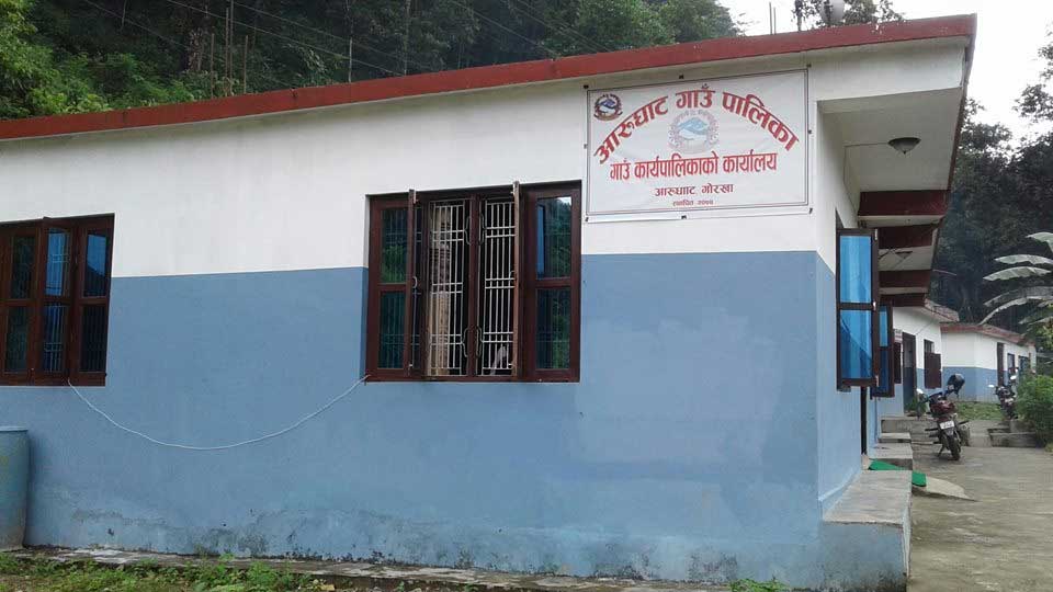
Going back to the roots of the trade of this seemingly buzzing marketplace, now the location of the Rural Municipality office, it is stated that Arughat bazaar was the trade center for the people of Dhading and Gorkha as the ancient business trail to Tibet passed through the area. Also AArughat Bazar was the route for many in the western districts of Tanahun, Kaski, etc. to reach Kathmandu.
Arughat Rural Municipality lies in Province no.4 and was formed after the declaration of local levels by Nepal government on 27 Falgun 2073 by merging 5 previous VDCs (Aruchanaute, Arupokhari, Aruarbang, Manbu and Thumi).
The total population of the rural municipality as per the CBS, National Census 2011 (2068 B.S.) is 23887. The population density as such is found to be 148 person per sq. km. Geographically the topography is difficult as the rural municipality lies in lesser himalayan region that consists of hard unfossiliferous rocks. The rural road network has touched almost all the wards however, most of the roads are earthern and fair weather roads.
Ethnically the rural municipality has a large population of Gurung followed by Brahman and Chhetris wheras, population of other ethnic composition such as Damai, Baram, Thakuri, Gharti etc. also reside in the rural municipality.
Topographically, AArughat-9 is the lowest level regarding altitude wheras AArughat-1 lies in the highest altitude among all the wards. AArughat-9 is situated in the banks of Budhigandaki, and is warmer with a tropical climate as compared to other wards that mostly have sub-tropical type of climate. AArughat 1 and 2 are situated in a higher altitude and have a upper tropical climate with temperate climate at some places.
AArughat-9 is the major market center where trade and agriculture are the major source of income, AArughat-10,5,6,7,8 are mostly dependent only upon agriculture for income wheras, Arughat 1,2,3,4 benefit from tourism as well.
The prospect of tourism is very good for the rural municipality being already famous for two trekking routes: Manasulu circuit trek and Tsum valley side-trek. A number of tourists trek through the rural municipality. However, the route only touches AArughat-9,10 and 6 number wards. The prospect however lies that the tourists can be lured to other possible trekking routes.
Historically, before the unification of Nepal by Prithvi Narayan Shah, Aarughat was a separate kingdom set in Aarukot, now in ward-8, Aarughat RM. There is a historic pond and place converted to school, viz. Durbar High School. Archeologically, the site is of high importance.
Various archeological findings such as silver utensils, historic tools, etc. have been excavated from the site.
Similarly in Ward no.2, Ghamlinggadi, reminiscence of palace of Bhot Raja were excavated and can be a significant archeological and tourist destination.