Overview
Mai Municipality (Nagarpalika) lies in the Ilam District of Koshi Province. It was formed following the structure published in the Nepal Gazette by merging the Danabari, Chisapani, Mahamai Village Development Committees, and Ward No. 5 of Lakshimpur.
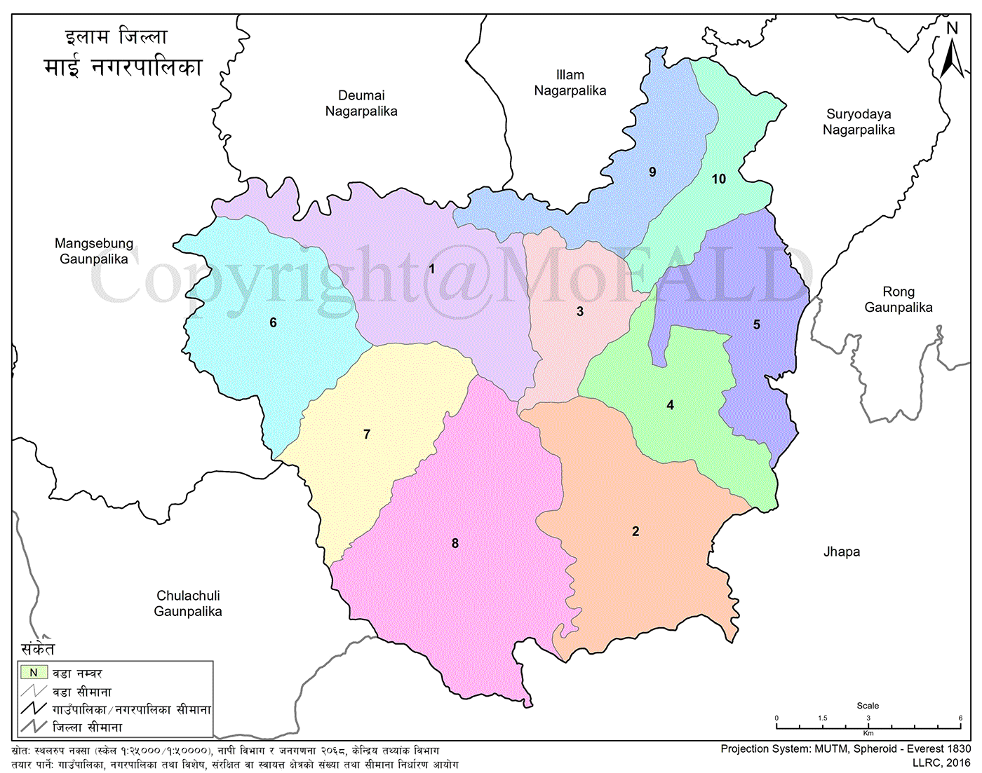
The total area of the Mai Municipality is 246.09 square kilometers, currently divided into 10 wards. Geographically, it is located at 26°45' North latitude and 87°52' East longitude.
With a population of 30,732, it ranks as the second-largest local level in Ilam by area, while being the municipality with the lowest population.
Bordering Municipalities and Location Center
Mai Municipality is bordered by:
-
East: Suryodaya Municipality and Rong Rural Municipality
-
West: Mangsebung and Chulachuli Rural Municipalities
-
North: Ilam and Deumai Municipalities
-
South: Arjundhara, Kankai, and Shivsatakshi Municipalities of Jhapa District
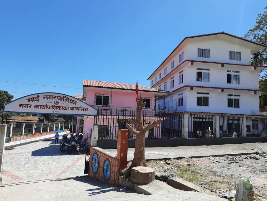
The administrative center is currently located at Ward No. 2, Shitali.
Economic Activities and Agriculture
The area is recognized as a pocket zone for rice, banana, areca nut, and meat production within Ilam District. Tea cultivation is also significant in this region.
Many locals rely on foreign employment as a secondary source of income. In addition, people are involved in government and private services, security forces, and various businesses.
Forest and Biodiversity
The municipality is home to 60 community forests—the highest number in the district. It is rich in flora, including Sal, Simal, Karam, Lampate, Saj, and Chilaune trees. Medicinal plants like Chiraito, Harro, Barro, Tulsi, Amala, and Titepati are also found here.
Tourism and Cultural Sites
Tourist potential areas include:
-
Shitali Tea Garden
-
Shoktima Tea Garden
-
Shiv Pokhari
-
Jhandi Danda Shivalaya
-
Purve Jhora
-
Gitti Danda
-
13 wetland ponds
Social and Cultural Composition
The municipality is home to a diverse population, primarily comprising the Limbu, Tamang, Rai, Magar, Newar, Kumal, Brahmin, Chhetri, and Dalit communities.
Major religions are Kirat, Hinduism, Buddhism, and Christianity. Key festivals celebrated include:
-
Dashain and Tihar
-
Lhosar
-
Udhauli and Ubhauli
-
Dhan Nach
-
Chandi Nach
-
Buddha Jayanti
-
Eid
Despite its diversity, unity in culture and social harmony remain core values.
Healthcare and Education
All 10 wards have basic health posts and health centers. A 15-bed hospital is under construction at the municipal center in Shitali.
Educational institutions include:
-
44 community schools
-
14 private schools
Infrastructure and Connectivity
Infrastructure developments since becoming a local level include:
-
Blacktopped road from Khudunabari–Sukhani–Rajduwali section
-
Sukhani–Lodia and Musekhola blacktopped roads
-
Mai Bridge, Lodia Bridge, and Sukhani Bridge
-
Road connectivity to all wards
-
Contract awarded for Mahamai–Mangsebung blacktopped road
Naming and Historical Context
The municipality spans 246.11 square kilometers and is divided into 10 wards. Located at 26°45’ N and 87°52’ E, it has a population of 32,576. Though large in area, it has the lowest population among municipalities in Ilam.
Mai is named after the historic and prominent Mai River that flows through its land.
It is known for:
-
Limbu ethnic majority
-
Tea farming
-
High number of community forests
-
Tourism potential
Governance and Institutional History
Mai Municipality was established during Nepal's federal restructuring and lacks comprehensive data on gender or ethnicity. As a newly declared municipality, it started with minimal internal resources.
Initially, operations were managed by a small team of staff members. During the early federal years, Mayor Deepak Kumar Thebe and other representatives managed tasks manually, carrying files in bags.
Today, the office is better equipped, though archival and record management systems are still being developed.
Although a budget was allocated and a consultancy agreement was signed to prepare the municipality's profile last year, the report has yet to be submitted.