Dhunibeshi Municipality (Nagarpalika) is located in Dhading, a hilly district under Bagmati Province of Nepal. It shares borders with Belkotgadhi Municipality and Kakani Rural Municipality of Nuwakot in the north, Nagarjun and Chandragiri Municipalities of Kathmandu in the east, Thaha Municipality of Makwanpur in the south, and Thakre Rural Municipality (Dhading) in the west.
The municipality covers a total area of 98.64 square kilometers and was formed by merging the former Village Development Committees (VDCs) of Chhatredeurali, Jeevanpur, and Naubise. According to the 2021 census, it comprises nine wards and has a total population of 29,149.
Dhunibeshi became the second municipality in Dhading District based on the decision made by the Government of Nepal on 11 Falgun 2073 B.S. (February 23, 2017 A.D.).
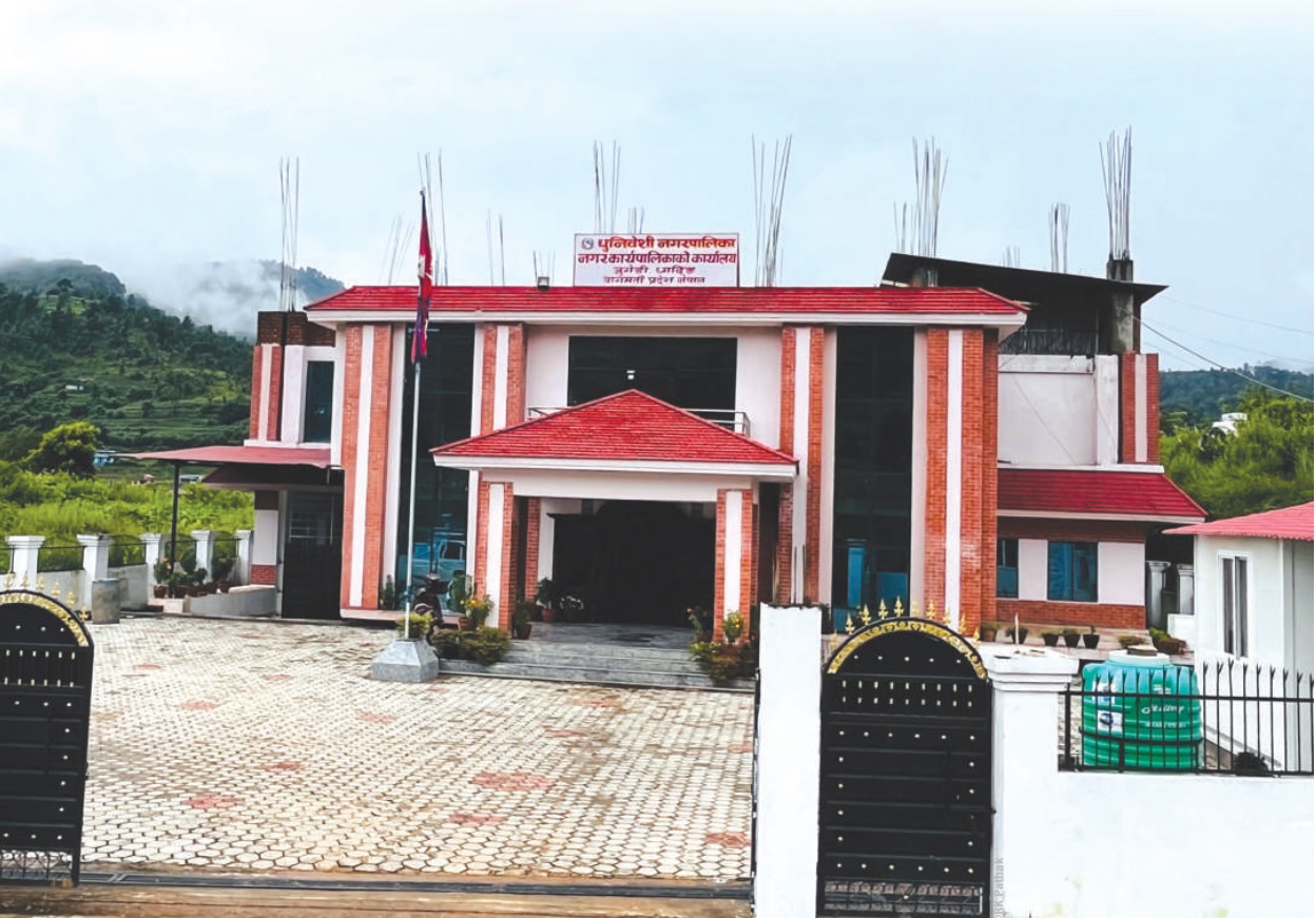
Established on 27 Falgun 2073 B.S., Dhunibeshi lies at the gateway to Kathmandu, Nepal’s capital. The boundary and structure were formalized based on recommendations from the government-appointed commission tasked with restructuring local units, per the Constitution of Nepal.
Located 20 km from the federal capital Kathmandu and 70 km from Dhadingbesi, the district headquarters, the municipality spans 98.64 square kilometers.
The Prithvi Highway and Tribhuvan Highway pass through the municipality and intersect at Naubise Bazaar. Major local market centers include Khanikhola, Naubise, and Dharke. All wards are connected by motorable roads, most of which are gravelled, with some undergoing blacktopping.
Various accounts exist regarding the origin of the name "Dhunibeshi." Some believe it comes from the Dhunikhola (stream), with the surrounding area toward the lowlands called Dhunibeshi. Others suggest it was named due to the presence of sugarcane and the continuous operation of local furnaces ("dhuni") for making molasses. The name "Dhunibeshi" derives from this historic municipality location.
East: Chandragiri Municipality, Nagarjun Municipality, Tarkeshwor Municipality, Shivapuri National Park, Kathmandu
West: Thakre Rural Municipality, Dhading
North: Belkotgadhi Municipality and Kakani Rural Municipality, Nuwakot
South: Thaha Municipality, Makwanpur
The municipality was formed by integrating areas from three previous VDCs: Chhatredeurali, Jeevanpur, and Naubise. The composition of wards is detailed below:
Ward 1: Chhatredeurali (Wards 6, 7, 8, 9) — Office: Bhanyang Pokhari
Ward 2: Chhatredeurali (Wards 1, 2, 3, 4, 5) — Office: Ratamate
Ward 3: Jeevanpur (Wards 5, 6, 7) — Office: Jeevanpur
Ward 4: Jeevanpur (Wards 1, 2, 3, 4) — Office: Bhanyang Amlechour
Ward 5: Jeevanpur (Wards 8, 9) — Office: Gaucharan
Ward 6: Naubise (Wards 1, 9) — Office: Khanikhola
Ward 7: Naubise (Wards 7, 8) — Office: Ramaailo Chaur
Ward 8: Naubise (Wards 2, 6) — Office: Khanikhola
Ward 9: Naubise (Wards 3, 4, 5) — Office: Tyalghar Naya Basti
Based on GIS data, the municipality's terrain includes:
Slopes up to 5°: 5.02% of area
Slopes between 5°–15°: 15.44%
Slopes between 15°–30°: 43.02%
Slopes between 30°–45°: 32.22%
Slopes above 45°: 4.31%
According to GIS-based classification:
Forest-covered land: 11.98%
Cultivable land: 62.32%
Rocky area: 0.11%
Water bodies: 0.00%
Other: 25.58%
Dhunibeshi is rich in historic, religious, cultural, and tourist destinations, including:
Maheshnarayan Cave
Bachhaladevi
Kotakalika
Chameru Cave
Gorakhnath Baba
Devidaurali
Kalidevi
Setidevi
Toplang View Tower
Nirveshwar Mahadev
Jhyampal Khola Waterfall
Sitapaila
Temples like Baghbachhaladevi and Gorakhnath Baba offer visitors devotional music services. Prioritizing religious and cultural preservation and tourism development, the municipality has undertaken construction and renovation projects including temples, cremation sites, patis (resting places), chaubaras, gumba (monasteries), picnic spots, and the Toplang View Tower.
Ongoing efforts aim to identify, conserve, and promote these sites for cultural and touristic value.




.jpg)