Overview
Miklajung Rural Municipality, Panchthar- The name “Miklajung” originates from the Limbu language. In Limbu, “Mikla” means “Malingo,” a type of tall, dense bamboo found in hilly regions. The term “Jung” is believed to be a derivative of “Jang,” meaning “top” or “peak.” Together, “Miklajung” translates to “Peak of Malingo,” referring to a hilltop covered with this bamboo, visible from far distances.
Miklajung is not only a name but also a natural landmark. The Miklajung hill lies about 2,700 meters above sea level to the south of the current rural municipality office in Rabi Bazaar. It forms a tri-junction of Panchthar, Ilam, and Morang districts. Its key attraction is the scenic sunrise and clear weather, offering views of ten eastern districts of Nepal and parts of Bihar and West Bengal in India (District Profile, 2075).
This region is known for its rich biodiversity, housing numerous medicinal herbs, forest resources, wildlife, and water sources. It connects to the Charkose forest through Morang’s Ramite area. The location also holds historical importance. Folklore states that during the Mahabharata era, the five Pandavas cooked their meal on a large rock in this area during their mountain journey. The cave where Nepal’s 16th national luminary, Mahaguru Falgunanda, once meditated, remains preserved here.
Due to its cultural, historical, and ecological significance, the municipality is named after the Miklajung hill itself.
Transition to Federal Structure
Nepal transitioned from a unitary, centralized system to a federal democratic republic. Under this federal setup, the country formed seven provinces and 753 local levels, including eight local units in Panchthar District.
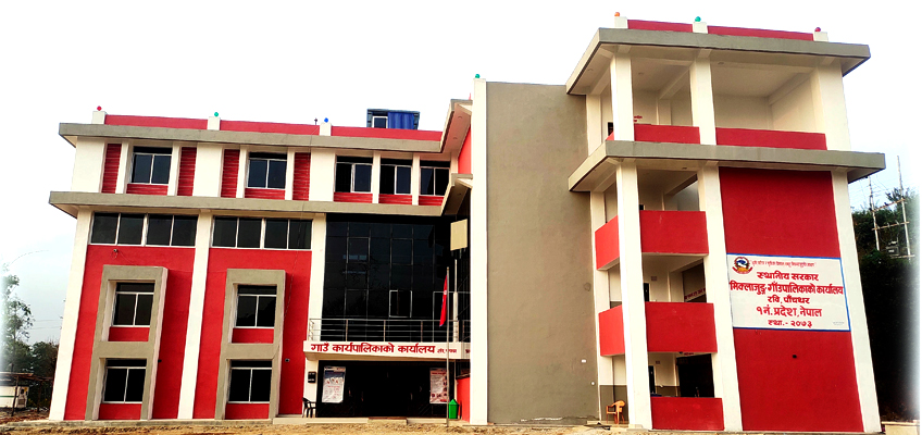
Miklajung Rural Municipality is located in Panchthar District of Koshi Province. Spanning 166.61 sq. km, it is home to 21,061 people, comprising 10,454 males and 10,607 females. Men make up 49.6% and women 50.4% of the total population. The municipality contains 5,459 households.
This local unit was officially formed following a notice in the Nepal Gazette on 2073/11/27 BS and subsequent decisions at the secretary-level of the Government of Nepal. For administrative efficiency and accessible public service delivery, it is divided into eight wards.
The former Village Development Committees (VDCs) of Sarangdanda, Rabi, Aarbote, Kurumba, Limba, and Durdimba were merged to form this rural municipality.
It shares borders with Fakfokthum Rural Municipality (Ilam) to the east, Tumbewa Rural Municipality to the west, Falgunanda Rural Municipality to the north, and Chhoubise and Mangsebung Rural Municipalities to the south.
Demographic and Ethnic Composition
Situated in the southwestern remote belt of Panchthar District, this area is predominantly home to various indigenous and ethnic communities:
-
55% Limbu
-
15% Rai
-
12% Tamang
-
10% Chhetri and Brahmin
-
3% Magar
-
2% Dalit
-
2% Sunuwar
-
1% Newar
The administrative center is located in Rabi, approximately 49 kilometers from Fidim, the district headquarters.
Natural and Cultural Landmarks
Miklajung Rural Municipality is enriched with remarkable natural sites and landmarks, including:
-
Miklajung Hill
-
Jaributte Hill
-
Chhalasukuwa Hill
-
Yawaran Waterfall
-
Indreni Waterfall
-
Jhankri Waterfall
-
Serekhemba Waterfall
-
Gojula Bhojola Lake
-
Kamal Pokhari
-
Hile Danda
-
Behuli Dhunga
-
Falgunand Park
-
Hile Pokhari
-
Petare Pokhari
-
Nagi Hill
-
Shiva Temple
-
Gumbadanda
-
Sencheling Tea Estate
-
Thokmechamba Manghim
-
Tare Dhunga
-
Saptakanya Lake
These natural resources define the municipality’s ecological beauty and cultural richness.
Geographic Location
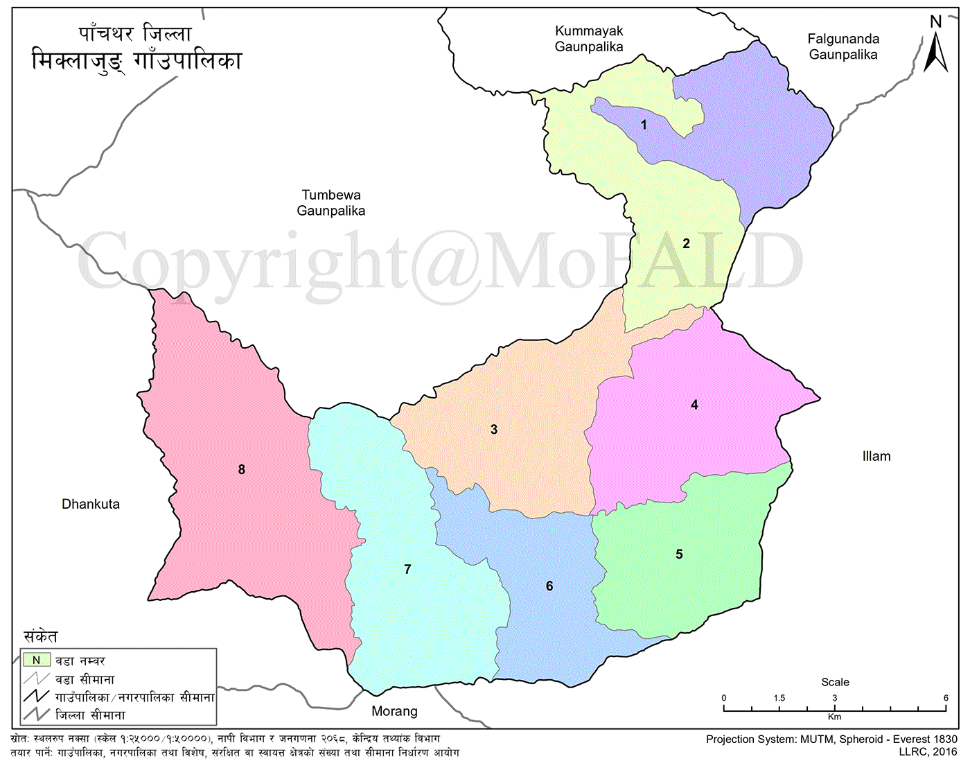
Miklajung Rural Municipality lies between 609 meters and 2,400 meters above sea level. Its geographic coordinates (based on the Geographic Coordinate System) are:
-
Latitude: 26°55′44″N
-
Longitude: 87°37′41″E
The total area spans 166.61 sq. km, of which:
-
Approximately 66.75 sq. km is used for agriculture
-
About 83.18 sq. km is forest and jungle
-
Around 16.67 sq. km falls under other categories
Political and Administrative Division
The rural municipality was established on 2073 Falgun 27 BS by merging the previous VDCs of Sarangdanda, Rabi, Aarbote, Limba, and Durdimba.
It is divided into 8 administrative wards and lies south of the Panchthar district headquarters. It is approximately 55 km from the district capital.
Bordering Administrative Units
-
East: Fakfokthum and Mangsebung Rural Municipalities of Ilam
-
West: Chhoubise Rural Municipality of Dhankuta and Tumbewa Rural Municipality of Panchthar
-
North: Kummayak, Falgunanda, and Tumbewa Rural Municipalities of Panchthar
-
South: Mangsebung and Chulachuli Rural Municipalities of Ilam and Miklajung Rural Municipality of Morang
Area
-
Total Land Area: 166.61 sq. km
-
Latitude: 26°55′21.74″N
-
Longitude: 87°41′8.91″E
Administrative Information
-
Province: Koshi
-
District: Panchthar
-
Municipality: 1
-
Rural Municipalities: 7
-
Center of Miklajung Rural Municipality: Rabi, Panchthar
-
Total Wards: 8
Formation and Administrative Evolution
Miklajung Rural Municipality is located in the south-southeastern region of Panchthar District, eastern Nepal. Its administrative center lies approximately 59 kilometers from Fidim, the district headquarters.
During Nepal’s state restructuring, this municipality was formed by merging six former Village Development Committees (VDCs): Sarangdanda, Aarbote, Rabi, Kurumba, Limba, and Durdimba. It has been organized into eight wards.
-
Wards 1 and 2 were created by dividing former Sarangdanda VDC (Wards 1–4 became Ward 1; Wards 5–9 became Ward 2)
-
Ward 3 consists of the former Aarbote VDC
-
Ward 5 includes Wards 1–8 of the former Kurumba VDC
-
Ward 6 was formed by combining Ward 9 of Kurumba and Wards 1, 3, and 9 of Limba VDC
-
Ward 7 includes Wards 4–8 of the former Limba VDC
-
Ward 8 comprises the former Durdimba VDC
This administrative structuring was done to support localized governance and enhance service accessibility for residents.
Religious, Cultural, and Tourist Attractions
Sites of Natural and Cultural Importance
Miklajung Rural Municipality is dotted with naturally scenic and culturally significant locations. These sites reflect both spiritual and ecological richness.
Key religious, cultural, and natural attractions include:
-
Miklajung Hill
-
Lekgau
-
Gudhla
-
Yawaran Waterfall
-
Bhujla Lake
-
Kamal Pokhari
-
Behuli Dhunga
-
Chamere Cave
-
Saptakanya Lake
-
Thokpechomma Manghim
-
Dhengen Cultural Site
Other culturally important areas and marketplaces include:
-
The historic Rabi Bazaar
-
Saptami
-
Chisapani
-
Budhabare Bazaar in Ward 6
-
Aarubote Bazaar
Prominent tourism and religious destinations also feature:
-
Senchelung Tea Estate
-
Buddha Park
-
Swargapuri Temple
-
Several Buddhist monasteries (Gumbas)
Cultural Promotion Efforts
The rural municipality has been actively allocating budget to preserve and promote local culture and heritage. Construction and restoration of temples, shrines, and monasteries are ongoing under both short-term and long-term development plans.
This effort has already begun attracting internal and domestic tourists to the area.
Education, Health, and Administrative Services
Public Services and Institutional Facilities
Miklajung Rural Municipality hosts a range of basic public services and facilities:
-
Administrative Offices
-
Area Administration Office
-
Area Police Office at Rabi
-
Four Police Posts
-
Nepali Army Security Unit at Budhabare (Ward 6)
-
Area and Additional Postal Offices in 8 locations
-
-
Health Services
-
1 Primary Hospital
-
5 Health Posts
-
4 Community Health Units
-
Total Health Centers: 10
-
-
Media
-
1 FM Radio Station: Radio Rabi 107.7 MHz
-
-
Banking and Finance
-
Nepal Bank Limited
-
Agricultural Development Bank
-
Himalayan Bank
-
Gorkha Finance
-
-
Education
-
1 Community Campus: Ravi Campus
-
11 Secondary Schools
-
45 Basic (Primary and Lower Secondary) Schools
-
45 Early Childhood Development Centers
-
-
Cooperatives and Microfinance
-
25 Cooperatives
-
3 Microfinance Institutions
-


