


Overview
Phalgunanda Rural Municipality is one of these units, located in Panchthar District of the Mechi Zone. With an approximate population of 25,000, the rural municipality covers a wide geographical area. It was formally established following the publication of a notice in the Nepal Gazette on 2073/11/27 B.S. and subsequent decisions made at the secretariat level.
Nepal has transitioned from a unitary and centralized system to a federal democratic republic. Under this structure, the nation is organized into three tiers—federal, provincial, and local levels—comprising 753 local units nationwide. Among them, eight local units have been established in Panchthar District.
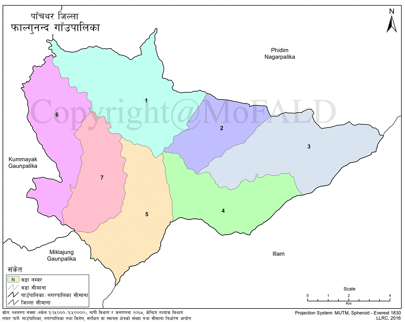
To ensure effective service delivery to local residents, the rural municipality has been divided into seven wards. It was formed by merging the former Village Development Committees (VDCs) of Nawamidanda, Imbung, Pauwa Sartap, Chilingdin, Faktap, and Aangsarang.
Geographical Borders and Location
-
East: Phakphokthum Rural Municipality of Ilam District
-
West: Kummayak Rural Municipality
-
North: Phidim Municipality
-
South: Miklajung Rural Municipality
Phalgunanda lies in the remote southwestern region of Panchthar District. The administrative center of the municipality is approximately 15 kilometers from Phidim.
Demographic Composition
The rural municipality is known for its ethnic diversity, with a predominantly indigenous population. The population distribution is as follows:
-
55% Limbu
-
15% Chhetri and Brahmin
-
10% Rai
-
10% Tamang
-
5% Dalit
-
1% Sunuwar
-
1% Magar
-
1% Newar
-
2% other minorities, including Majhi and Kumal
Cultural and Religious Sites
The municipality is enriched with natural beauty and religious heritage. Notable sites include:
-
Labrekuti
-
Silaute Hill
-
Pauwa Bhanjyang
-
Tijok Hill
-
Namtok Hill
-
Sukepokhari
It also features several religious landmarks such as:
-
Namsami–Kesami
-
Yuma Manghim
-
Singhadevi Temple
-
Sapshu, a sacred pilgrimage site located near the Nibu River
Geographic Coordinates and Elevation
-
Latitude: 26°59'32.0712" N to 27°06'16.8156" N
-
Longitude: 87°40'06.042" E to 87°50'40.9668" E
The elevation of the area ranges from 605 meters to 2,985 meters above sea level.
Administrative Structure
-
Total Wards: 7
-
Administrative Center: Ward No. 5, Faktap
-
Total Area: 107.53 square kilometers
Phalgunanda Rural Municipality is one of the seven rural municipalities among eight local units in Panchthar District. It is situated within the middle hill physiographic region and remains rich in indigenous culture and natural diversity.

.jpg)


