


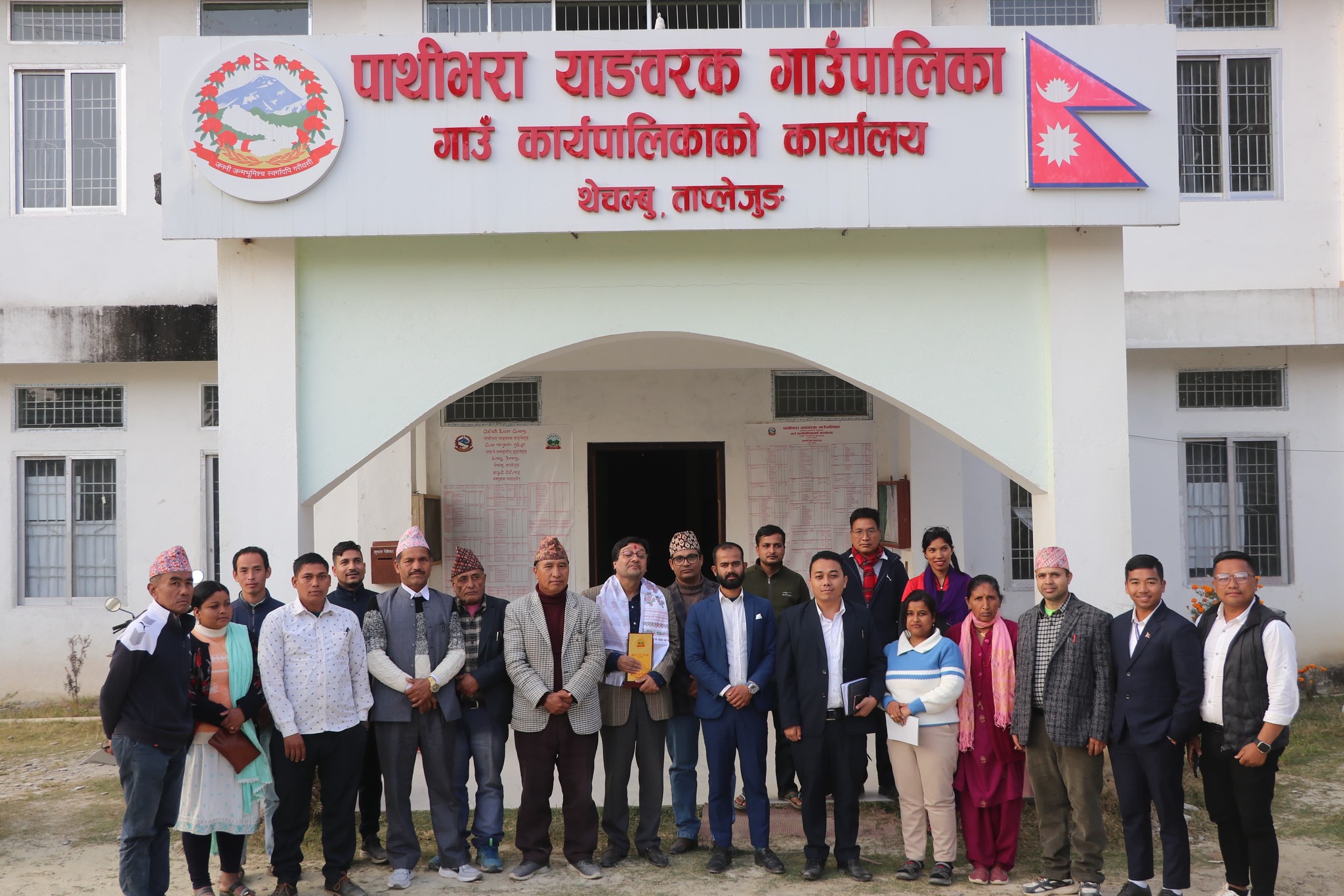
Overview
Pathibhara Yangwarak Rural Municipality (Gaupalika - पाथीभरा याङवरक गाउँपालिका, ताप्लेजुङ) is located in the eastern region of Taplejung District within Koshi Province, Nepal. It spans an area of 92.76 square kilometers and has a total population of 11,806, based on the National Census 2078.
It is bordered by Sirijanga Rural Municipality to the east and north, Fungling Municipality to the west, and the Kabeli River along the southern boundary shared with Taplejung and Panchthar districts.
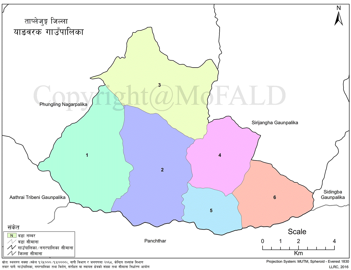
Pathivara Yangwarak Rural Municipality is divided into 6 wards and is home to several tourism sites, including Khesani Namsani, Todke Pahara, Dhaps Pokhari, Sirijanga Manghim, and Sambachyo Khyorling Monastery.
Ward Division
-
Ward 1 – Nangkhokyang
Population: 3,256
Area: 21.045 sq. km -
Ward 2 – Thechambu
Population: 3,141
Area: 21.313 sq. km -
Ward 3 – Tiringe
Population: 1,546
Area: 20.751 sq. km -
Ward 4 – Dumrise
Population: 1,294
Area: 11.852 sq. km -
Ward 5 – Chaksibote
Population: 807
Area: 6.785 sq. km -
Ward 6 – Thumbedin
Population: 1,762
Area: 11.014 sq. km
Background and Context
Pathibhara Yangwarak lies 6 kos (approx. 18 km) from the Taplejung district headquarters and 247 kilometers east of Kathmandu. Geographically remote, it is characterized by hilly terrain and is predominantly inhabited by the Limbu community, along with Rai, Tamang, Newar, Kami, Damai, Sarki, Gurung, Sunuwar, and Brahmin ethnic groups.
Students here walk up to one and a half hours daily to reach schools. The area has:
-
6 secondary schools
-
8 lower secondary schools
-
22 primary schools
Agriculture is the main occupation, though limited cultivable land and economic hardship have pushed many to seek foreign employment. Roads like Pathibhara Agricultural Road, Sirudanda-Chaksibote Mavi Deuling-Thechambu Road, Khare-Thechambu Road, Taplejung Suketar-Tiringe Road, and Kabeli-Thumbedin-Tintama-Dumrise Road have recently increased access and interest in cash crops.
Despite Taplejung being a major cardamom-producing district, Yangwarak has limited output. Foreign employment remains the top priority for income. The area lacks substantial government services except one health post and one auxiliary post office.
The local economy relies on selling agricultural produce and daily goods, often sourced from Taplejung or neighboring Amarpur VDC’s Bhaluchowk market in Panchthar. With only 15% of land arable, and the rest covered by forest, cliffs, and landslides, the overall living standard remains low.
Recent road construction has improved access, but transportation is largely limited to the dry season. Effects of globalization are minimal. Educational levels remain low, but the municipality is moving toward full immunization. Wards 2, 3, 4, and 6 have already been declared fully immunized, while Wards 1 and 5 are nearing completion.
Historical Background and Name Origin
Before Nepal’s unification, Taplejung was part of the Kirat region, known as “Pallo Kirat.” The name “Taplejung” originated from a local Bhote king, “Taple,” who ruled from Jong Fort. The present municipality was formed by merging former VDCs: Nangkhokyang, Thechambu, Tiringe, Dumrise, Chaksibote, and Thumbedin.
In the Limbu language, “Yang” means money and “Warak” means pond. Thus, “Yangwarak” signifies "money pond." Geographically, it lies at 27°31' North latitude and 87°75' East longitude, with an average temperature of 19.5°C. It falls under Constituency No. 1 of Taplejung.
The center of the municipality is Purne Danda in Thechambu.
Geography and Climate
Geographic Location of Yangwarak Rural Municipality
-
Province: Koshi Province
-
District: Taplejung
-
Latitude: 27°31' N
-
Longitude: 87°75' E
-
Boundaries:
-
East and North: Sirijanga Rural Municipality
-
West: Fungling Municipality
-
South: Kabeli River and Panchthar district
-
Former VDCs (Census 2068):
-
Nangkhokyang: Population 3,768 | Area: 21.045 sq. km
-
Thechambu: Population 1,703 | Area: 21.313 sq. km
-
Tiringe: Population 3,386 | Area: 20.751 sq. km
-
Dumrise: Population 1,559 | Area: 11.852 sq. km
-
Chaksibote: Population 908 | Area: 6.785 sq. km
-
Thumbedin: Population 2,267 | Area: 11.014 sq. km
Total: Population 15,124 | Area: 92.76 sq. km
Climate:
-
Average Temperature: 19.5°C
-
Minimum Temperature (Poush): 0°C
-
Maximum Temperature (Jestha): 34°C
-
Average Rainfall: 1,645 mm
Local Festivals, Jatras, and Fairs
| Festival / Jatra | Observed In | Ethnic/Religious Group |
|---|---|---|
| Dashain | Ashwin Shukla Pratipada to Purnima | Hindu communities |
| Tihar | Kartik Krishna Trayodashi to Shukla Dwitiya | Hindu and others |
| Sonam Lhosar | Magh Krishna Pratipada | Tamang Buddhist communities |
| Chandi | Baisakh Shukla Purnima | Rai communities |
| Chasok Tangnam / Nwagi | Mangsir Shukla Purnima | Limbu communities |
| Gyalbo Lhosar | Falgun Shukla Pratipada | Sherpa communities |
| Tamu Lhosar | Poush Shukla Dwadashi | Gurung communities |
| Teej / Purnima Fair | Bhadra Shukla Tritiya and every full moon | Hindu women |
Major Tourist Attractions
-
Khesani Namsani – Ward 1
Historic and cultural site; lacks formal tourism promotion -
Todke Pahara – Ward 5
Historical site; no structured tourism development -
Dhappokhari – Ward 5
Scenic natural pond; not yet promoted for tourism -
Sirijanga Manghim – Ward 3
Religious site; underutilized in tourism -
Sambachyo Khyorling Monastery – Ward 4
Buddhist monastery of cultural significance
Schools in Pathibhara Yangwarak Rural Municipality
-
Pre-schools: 32
-
Basic Schools: 36
-
Secondary Schools: 6
-
Plus-2 Level Schools: 4
-
Public Schools: 36
-
Private Schools: 1
-
Total Schools: 37
Private School
-
Himalayan New Life Academy – Pathibhara Yangwarak – (Nursery–3)
Secondary Schools (Class 1–12, NEB Affiliated)
-
Thechambu Secondary School – Thechambu – (1–12)
-
Chaksibote Secondary School – Chaksibote – (1–12)
-
Kalika Secondary School – Nangkholyang – (1–12)
-
Sharada Secondary School – Thumbedin – (1–12)
Secondary Level Schools (Nursery–10)
-
Kalika Secondary School – Pathibhara Yangwarak – (Nursery–10)
-
Siddheswari Secondary School – Dumrishe – (Nursery–10)
Basic Level Schools
-
Himalayan Basic School – (Nursery–8)
-
Siddha Kumari Basic School – (Nursery–8)
-
Laxmi Basic School – (Nursery–8)
-
Kumbhakarna Basic School – (Nursery–8)
-
Thechambu Basic School – (Nursery–8)
-
Mahakali Basic School – (Nursery–8)
-
Saraswati Basic School – (Nursery–5)
-
Yuwa Basic School – (Nursery–5)
-
Janata Basic School – (Nursery–8)
-
Nepal Rastriya Basic School – (Nursery–8)
-
Tribhuwan Basic School – (Nursery–5)
-
Pathibhara Basic School – (Nursery–5)
-
Pipleshwori Basic School – (Nursery–5)
-
Nawa Jyoti Basic School – (Nursery–5)
-
Chandeshwari Basic School – (Nursery–5)
-
Katike Basic School – (Nursery–5)
-
Araniko Basic School – (Nursery–3)
-
Triveni Basic School – (Nursery–3)
-
Sangtha Basic School – (Nursery–5)
-
Singha Kali Basic School – (Nursery–3)
-
Sundarmala Basic School – (Nursery–3)
-
Bishwo Jyoti Basic School – (Nursery–3)
-
Danda Basic School – (Nursery–5)
-
Dipjyoti Basic School – (Nursery–3)
-
Sarada Basic School – (Nursery–3)
-
Prithvi Basic School – (Class 1–4)
-
Saraswati Basic School – (Nursery–3)
-
Hangphabung Basic School – (Nursery–3)
-
Thakparu Basic School – (Nursery–5)
-
Jyoti Samudayik Basic School – (Nursery)

.jpg)


