


Overview
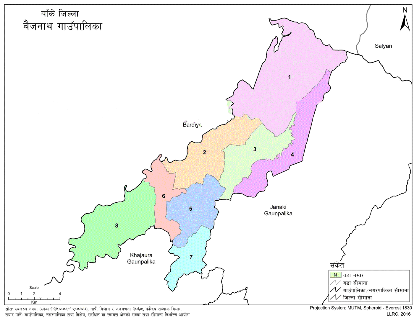
Baijanath Rural Municipality (Gaupalika - बैजनाथ गाँउपालिका) is situated in Banke District, within the Lumbini Province. Baijanath RM is bordered by Kohalpur Municipality to the east, Khajura Rural Municipality to the south, Mankhola to the west, and Bansgadhi Municipality of Bardiya District to the north.
The municipal center was initially established at the former office of Bankatwa VDC and is now situated in Ward No. 5, Rampur. This rural municipality was formed by merging the previous Village Development Committees (VDCs): Chisapani, Naubasta, Bankatwa, and Titihiriya.
The name "Baijanath" is historically and politically significant. It is named after Baijanath Tharu, who was born in Pedari, formerly Ward No. 3 of Bankatwa, and currently resides in Ward No. 7 of Baijanath.
Demographic and Cultural Composition
Baijanath is home to a diverse ethnic population, including Tharu, Muslim, Brahmin, Chhetri, Thakuri, and Dalit communities. While Hinduism is the predominant religion, there are also significant numbers of followers of Islam and Christianity residing in the area. The linguistic and cultural diversity contributes to a socially mixed and inclusive community.
Geography and Land Use
Located in the western Terai region, the terrain of Baijanath is predominantly flat. Although parts of the area near the buffer zones of Bardiya and Banke National Parks reflect some features of the Chure hills, most of the land remains plain and cultivable.
Agriculture is the dominant land use, covering the majority of the area, while forests—especially in the buffer zones—also account for a notable portion of the land.
Key Facts and Statistics
-
Latitude (North): From 28° 8' 38" to 30° 20' 16"
-
Longitude (East): From 81° 31' 5" to 81° 44' 11"
-
Elevation: 140 meters to 450 meters above sea level
-
Total Area: 141.67 sq. km
-
Total Wards: 8
-
Total Population: 69,282
-
Female: 34,085
-
Male: 35,197
-
-
Total Households: 13,987
-
Average Household Size: 4.94 persons
-
Literacy Rate:
-
Male: 93.97%
-
Female: 87.09%
-
Average: 90.53%
-
Current Wards and Former Administrative Units
-
Chisapani
-
Includes all 9 wards of the former Chisapani VDC
-
-
Digiya
-
Formed from Wards 1–3 of the former Naubasta VDC
-
-
Naubasta
-
Includes Wards 4–7 of the former Naubasta VDC
-
-
Baniyabhar
-
Includes Wards 8–9 of the former Naubasta VDC
-
-
Bankatwa
-
Formed from Wards 4, 6, 7, and 8 of the former Bankatwa VDC
-
-
Samjhana
-
Includes Wards 5 and 9 of the former Bankatwa VDC
-
-
Pedari
-
Includes Wards 1–3 of the former Bankatwa VDC
-
-
Titihiriya
-
Covers all 9 wards of the former Titihiriya VDC
-

.jpg)


