


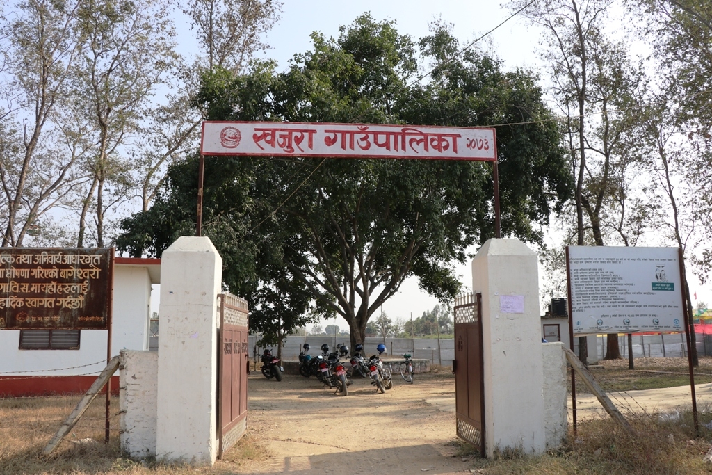
Overview
Khajura Rural Municipality (Khajura Gaupalika) is located in Banke District of Lumbini Province, Nepal, according to the latest administrative division. Due to minimal variation in elevation, the geography is considered favorable, ranging from 130 to 164 meters above sea level. It spans an area of 101.91 square kilometers.
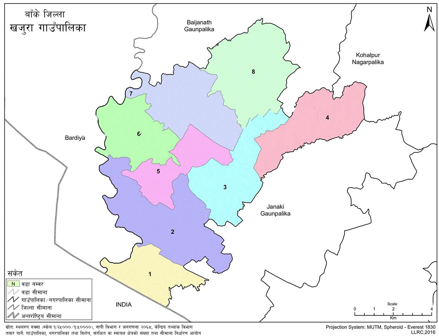
To its east lie Kohalpur Municipality and Janaki Rural Municipality; to the west is Bardiya District; to the north is Baijanath Rural Municipality; and to the south is India.
Administrative Formation
In line with the model drafted by the then Ministry of Federal Affairs and Local Development, the commission responsible for determining the number and boundaries of rural municipalities, municipalities, and special, protected, or autonomous regions submitted its report on 22 Poush 2073 BS.
Based on this report, the committee coordinated by the Minister of Federal Affairs and Local Development presented another report on 20 Falgun 2073 BS. Accordingly, on 22 Falgun 2073 BS, the Government of Nepal officially declared the formation of Khajura Rural Municipality by merging the former VDCs of Bageshwari, Sitapur, Radhapur, Udharapur, Sonpur, and Raniyapur into 8 wards.
Geographic and Demographic Overview
Khajura covers a total area of 101.91 square kilometers. According to the 2078 BS census:
-
Total Population: 62,789
-
Male Population: 29,579
-
Female Population: 33,210
-
Total Households: 13,706
The primary market centers are located in Ward No. 1 and Ward No. 2. Based on the 2078 census data, Khajura ranks third in terms of population size among all rural municipalities in the country.
Etymology and Cultural Landscape
Though the word Khajura means a thread for making traditional hair buns or palm leaves used for roofing, the name of the area is believed to have derived from Kan-khajura (centipede). Over time, Khajura has evolved as a multilingual, multicultural, and multi-religious geography.
Its identity has grown through the presence of jungle areas, the spread of centipedes, various settlements such as Chhoti Khajura and Badi Khajura, marketplaces like Bazar Khajura and Khajurakhurd, rehabilitation histories, migration patterns, and countless stories from older settlements.
Settlement and Ethnic Composition
The native Tharu community is considered the indigenous population of Khajura. Other ethnic groups settled here over time through various waves of migration. Some arrived around the time of the Anglo-Nepal War; others moved after the start of formal rehabilitation programs.
The stories of settlements in Eastern and Western Banke differ. Political geography reshapes itself over time—Khajura has undergone similar transformations.
Before 27 Falgun 2073 BS, today’s Khajura was made up of six separate Village Development Committees: Radhapur, Sitapur, Bageshwari, Sonpur, Udharapur, and Raniyapur. These areas were unified to form the new political boundary of Khajura Rural Municipality, which now comprises 8 wards spread across 102 square kilometers.
Settlement Characteristics
Sonpur, Udharapur, and Raniyapur are considered traditional settlements. Other areas were established later through forest clearance, resettlement, and migration. Raniyapur remains a Muslim-majority community. People from nearly every district of Nepal have migrated to settle in Khajura. It also served as a place of refuge for Nepali-speaking communities expelled from Burma and northeastern India.
Historical Timeline of the Region
The history of the Khajura region can be studied in four distinct periods:
-
Before the Anglo-Nepal War
-
From the Anglo-Nepal War (1816 AD) to 2007 BS
-
From 1951 AD to the beginning of the resettlement program
-
From the beginning of the resettlement program to the present (up to 2079 BS)
Geographical Location and Boundaries
Khajura Rural Municipality lies in Banke District of Province No. 5, Nepal, according to the country's latest administrative division. Geographically, it is located between 81°30'55" and 84°15'51" east longitude and between 27°39'02" and 27°46'36" north latitude. Situated in the flat plains of the Terai, it has minimal elevation variation, ranging from 130 to 164 meters above sea level. Covering an area of 101.91 square kilometers, Khajura borders Kohalpur Municipality and Janaki Rural Municipality in the east, Bardiya District in the west, Baijanath Rural Municipality in the north, and India in the south.
Ward Division of the Rural Municipality
-
Ward No. 1
-
Former VDC: Radhapur (Wards 1–9)
-
Area: 8.37 sq. km
-
-
Ward No. 2
-
Former VDC: Sitapur (Wards 1–9)
-
Area: 18.37 sq. km
-
-
Ward No. 3
-
Former VDC: Bageshwari (Wards 1–3, 5)
-
Area: 12.65 sq. km
-
-
Ward No. 4
-
Former VDC: Bageshwari (Wards 4, 6–9)
-
Area: 12.74 sq. km
-
-
Ward No. 5
-
Former VDC: Udharapur (Wards 1, 3–5, 8, 9)
-
Area: 8.57 sq. km
-
-
Ward No. 6
-
Former VDC: Udharapur (Wards 2, 6, 7)
-
Area: 10.68 sq. km
-
-
Ward No. 7
-
Former VDC: Sonpur (Wards 1–9)
-
Area: 14.2 sq. km
-
-
Ward No. 8
-
Former VDC: Raniyapur (Wards 1–9)
-
Area: 16.33 sq. km
-
Land Use Information
Human life and livelihood are based on the utilization of natural resources available on the Earth's surface. All human activities are fully dependent on land and its resources. Therefore, land use includes data on forests, cultivable land, water, sand, hills, and mountains.
Land Use Details
-
Cultivable Land: 87.96 sq. km (86.31%)
-
Residential Area: 8.56 sq. km (8.40%)
-
Water Bodies: 1.81 sq. km (1.78%)
-
Forest Area: 1.79 sq. km (1.76%)
-
Gardens: 0.56 sq. km (0.55%)
-
Sandy Areas: 0.46 sq. km (0.45%)
-
Grasslands: 0.45 sq. km (0.44%)
-
Ponds: 0.23 sq. km (0.22%)
-
Mining/Excavation Area: 0.05 sq. km (0.0%)
-
Barren Land: 0.04 sq. km (0.04%)
-
Brick Industry Area: 0.02 sq. km (0.02%)
-
Total: 101.91 sq. km (100.00%)
Cultural Characteristics
Intangible customs shape human behavior, language, traditions, and lifestyle. Social life is governed by familial and community structures, with practices like birth, death, marriage, attire, festivals, and language forming essential cultural aspects. These dimensions are key identifiers of people and help refine social living.
In Khajura, which is predominantly Hindu, major rituals include Kul Puja, Goth Puja, Bratabandha, weddings, funerals, annual ceremonies, naming ceremonies, memorials, Satyanarayan Puja, Yagyas, Rudri Path, and observances of solar and lunar eclipses. Traditional songs like Asare, Teej, Jhyaure, and Dohori are popular.
Major festivals include Baisakhi Purnima, Eid, Bakr-Eid, Muharram, Lhosar, Udhauli, Ubhauli, Buddha Purnima, Asar 15 (curd and beaten rice), Saune Sankranti, Nag Panchami, Rishi Tarpani, Dashain, Tihar, Deusi, Maghe Sankranti, Holi, Ram Navami, Haribodhini Ekadashi, Satthi, and Mha Puja of the Newar community.
Around 25% of the population in the rural municipality is Muslim. The population comprises various ethnic groups, each with its own distinct religious and cultural customs. Traditional attire includes fariya and cholo for women, and dhoti-kachhad or kurta-suruwal for men. Nowadays, younger generations prefer modern clothing, including pants, shirts, t-shirts, sarees, and kurtas. The lifestyles of the Newar, Danuwar, Bote, Kumal, Majhi, and Gurung communities also form a significant cultural heritage.
Key Development Potentials
Each region has distinct characteristics. Some have dense forests, others have abundant water resources, and some are dry. Agricultural commercialization and scientific forest management are potential avenues for local prosperity. In Khajura, forest and shrubland cover only 3.26% of the total area.
Potential areas for development include:
-
Traditional and modern agriculture
-
Medicinal herbs
-
Tourism
-
Animal husbandry
-
Small and medium-scale industries
-
Park, garden, monastery, and stupa development for tourism
Fertile land offers high agricultural potential. Although lacking modern tools and incurring high input costs, there is room for improvement in yields through better awareness, training, modernization, technology transfer, and input accessibility.
Declining soil fertility and the underutilization of arable land are concerns. Repairing traditional canals and promoting irrigation can enhance sustainability, transforming Khajura into a livable rural model.
Khajura has strong potential in dairy and livestock, especially if connected with transport networks. Opportunities include developing milk chilling centers, collection hubs, cold storage facilities, and meat processing industries, which can lead to increased employment and income growth.
If natural resources are harnessed with eco-friendly technologies, they can provide local employment and foster sustainable development.
Creating ponds and promoting fish farming could improve livelihoods. As unemployment and limited job opportunities persist, providing skill-based training and local employment could significantly improve Khajura’s economic status.
Additional development strategies include:
-
Irrigation through canals using local water sources
-
Drinking water expansion under the "One House One Tap" policy
-
Road upgrading and blacktopping to enhance accessibility and living standards
-
Promoting market access to nearby urban centers like Nepalgunj and Kohalpur
-
Expanding local industries to boost employment
-
Encouraging partnerships with public and private institutions
-
Developing trade and commerce in response to growing consumer demand

.jpg)


