


Overview
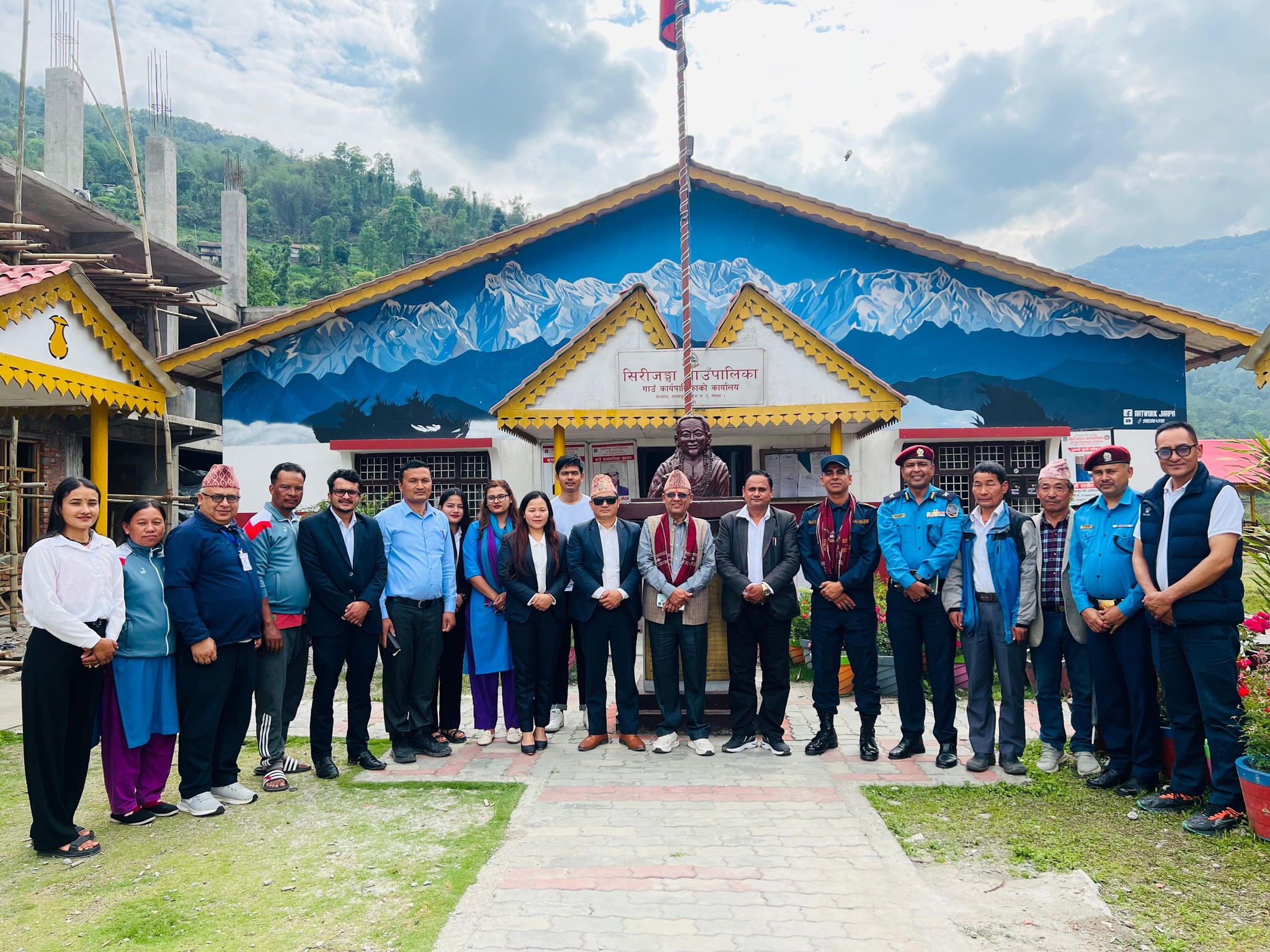
Sirijanga Rural Municipality is the easternmost among the eight rural municipalities in Taplejung District. The name honors Tyemsi Sirijanga Sing Thebe (1704–1741 BCE), the creator and custodian of the Limbu language and script. He was born in Ward No. 4, formerly known as Tellok VDC. In the 17th century, the combined area of present-day Sinam, Ambeghudin, Tellok, and Pedang was referred to as “Sinam.”
Area and Population
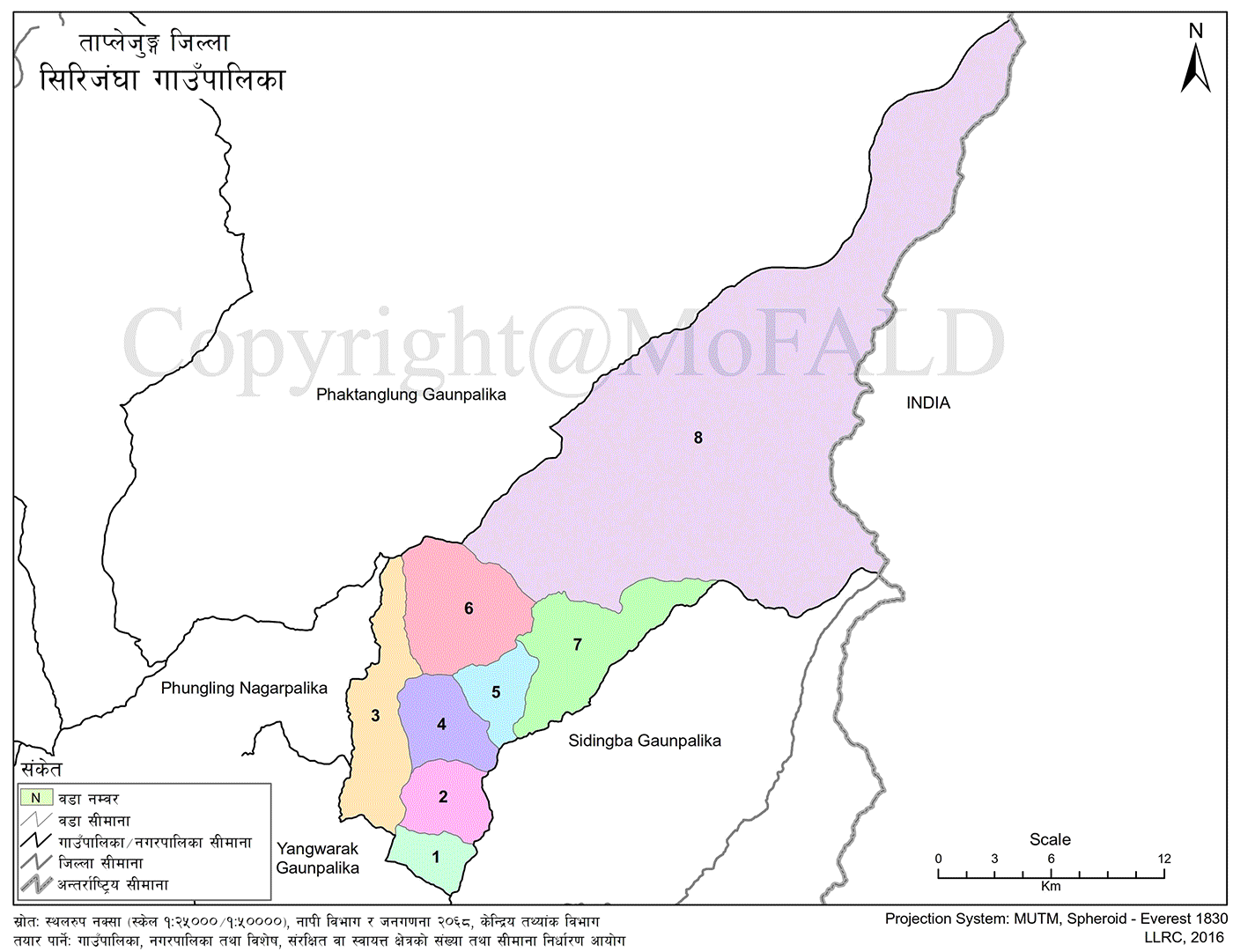
Sirijanga spans 481.09 square kilometers. As per the 2021 census, it has a population of 14,114. The rural municipality comprises 8 wards formed by merging the previous Village Development Committees (VDCs) of Sinam, Ambeghudin, Sikaicha, Tellok, Pedang, Mamankhe, Khewang, and Yamphudin. The administrative center is located in Tellok, now Ward No. 4.
Bordering Areas
-
East: Sidingwa Rural Municipality and India
-
West: Yangwarak Rural Municipality and Phungling Municipality
-
North: Phaktanglung Rural Municipality
-
South: Panchthar District
Notable Landmark
Ward No. 8 (Yamphudin) houses Mount Kanchenjunga (8,586 m), the world’s third and Nepal’s second-highest peak. Every year, both domestic and international trekkers follow the southern route: Suketar–Lalikharka–Khesewa–Mamankhe–Yamphudin–Cheram–Oktang, eventually reaching the Kanchenjunga Base Camp.
Cultural and Ecological Features
Although the Limbu community is predominant, Sirijanga promotes harmony among various castes, cultures, languages, and traditions. The area is rich in biodiversity, natural beauty, religious significance, and historical heritage.
Major Tourist Attractions
-
Kanchenjunga Conservation Area and trekking routes
-
Kanchenjunga Mountain and base camp trekking
-
Pathibhara Trekking Route
-
Sirijanga Temple and Cave
-
Danda Gaun Shiva Temple
-
Kirateshwar Temple (blessed by national figure Falgunanda)
-
Prabhu Thumka Hill
-
Potential rafting and kayaking on the Kabeli River
-
Barule Pond
-
Limbu Museum, Mamankhe
-
Natural Hot Springs (once bathed by Sirijanga himself)
-
Sacred Pathibhara Shrines
-
Ranke, Aukhaldunga Tavatar, and Khurpe Stone
Indigenous Communities and Culture
The Limbu people form the majority, but other ethnic groups are also present. In the Himalayan zone of Yamphudin, you’ll find Rais, Gurungs, Sherpas, and others—each with their distinct language, script, religion, attire, ornaments, cuisine, dance, and traditions.
Limbus preserve their cultural heritage through dances such as Dhan Nach, Chyabrung, Palam, and Hakwapare. The Khas Arya communities observe Dev Puja, Krishna Pranami, Dashain-Tihar, and other traditions. Ethnic groups like Magar, Tamang, Sunuwar, Bhujel, Kami, Damai, and Sarki also reside in this area.
Wildlife and Bird Species
Ward No. 8 (Yamphudin) falls within the Kanchenjunga Conservation Area, home to rare species like the snow leopard, red panda, and Himalayan black bear. Other wildlife includes musk deer, leopards, foxes, and bears. Bird species such as the Himalayan Monal (Danphe), munal, pheasant, kalij, and vultures are also found here.
Medicinal Herbs
While cardamom and chiraito are the primary commercial crops, higher altitudes are rich in herbs like panchaaule, bikhuma, kutki, sarmaguru, padamchal, pakhhanbed, and timur.
Access to the Municipal Center
-
By Road: Birtamod–Jhapa–Ilam–Phidim–Tharpu–Sinam–Khamdimbe–Hapukhola–Tellok
-
By Foot: Phungling Bazaar–Pathibhara route–Fawakhola–Sikaicha–Tellok
Historical Context
Located in the far east of Nepal, Sirijanga Rural Municipality represents the eastern charm of Province No. 1. It spans from 27°15” to 27°54” N latitude and 87°27" to 88°12" E longitude. It covers 3646 sq. km, accounting for about 0.003% of the world’s land area. The area is home to Kanchenjunga—the third-highest peak in the world—and the sacred Pathibhara Devi Temple.
Sirijanga was formed by merging eight VDCs after Nepal’s administrative restructuring. The main ethnic groups are Limbu, followed by Chhetri, Brahmin, Kami, Rai, Gurung, Sherpa, Sarki, Damai, and others.
Geographical Features and Boundaries
Sirijanga Rural Municipality occupies 13% of Taplejung’s land area. It covers 481.09 sq. km, making it the second-largest after Phaktanglung. It lies between 27°17" to 27°42" N latitude and 87°46" to 88°09" E longitude, with altitudes ranging from 900 m to 8,586 m. The area extends 43 km north to south and 43 km east to west.
-
East: India (Sikkim)
-
West: Yangwarak RM and Phungling Municipality
-
North: Phaktanglung RM
-
South: Sidingwa RM
Topography and Soil
Due to elevation differences of up to 7,686 meters, the region features high peaks, hills, valleys, rocky terrain, and a variety of soils, including loamy and clayey ones. The area is fertile and supports agriculture; however, traditional crops such as maize, millet, wheat, and barley still dominate. The vast open fields are ideal for animal husbandry (goats, sheep, yaks, cows, buffaloes).
The streams flow north to south and east to west, providing irrigation potential. The terrain supports diverse vegetation and climatic zones, ranging from tundra in the high Himalayas to subtropical zones, making it ideal for a variety of agricultural ventures.
Natural and Cultural Heritage
Sirijanga is adorned with towering peaks, including Kanchenjunga, and sacred rivers like the Kabeli, which originate from these ranges. Other attractions include:
-
Pathibhara Devi Temple
-
Limbu cultural sites and museum
-
Birthplace of Sirijanga Singh Thebe
-
Danda Gaun Shiva Temple
-
Kirateshwar Temple (site blessed by Falgunanda)
-
Prabhu Thumka, Banduke Pokhari, and Barule Pokhari
-
Hot water springs (once bathed by Sirijanga)
-
Small Pathibhara shrines, Khurpe Stone, and Chharwani Cave
Kanchenjunga Mountain
Located in Ward No. 8 (Yamphudin), Kanchenjunga (8,586 m) was first summited on May 24, 1955, by Joe Brown and George Band. Trekkers use two primary routes:
-
Route 1: Suketar–Deurali–Lalikharka–Kande Bhanjyang–Tellok–Fumpe–Mamankhe–Yamphudin–Amjikhola–Torongden–Cheram–Ramche Base Camp
-
Route 2: Ganesh Chowk–Sinam Panchami–Kabeli Jorpul–Tavatar–Prabhu Thumka–Yamphudin
The trek takes around 18 to 24 days. The mountain is one of the highest revenue-generating peaks in Nepal.
Kabeli River
Originating from Mount Kanchenjunga, the Kabeli River flows through the municipality throughout the year. It is culturally important, with beliefs surrounding its spiritual cleansing powers, especially during Makar Sankranti.
The river has significant hydropower potential. Kabeli A is an ongoing project, while Kabeli B, C, and D are under study. It may also serve as a site for rafting, enhancing its tourism appeal and potentially providing a shorter access route to Kanchenjunga Base Camp.
Pathibhara Devi Temple
Pathibhara is one of Nepal’s most revered pilgrimage sites. Located at 3,794 m on the border between Sirijanga (Sikaicha), Phungling Municipality, and Phaktanglung Rural Municipality, the temple sits atop a hill resembling a traditional grain container (“pathi”), giving rise to its name.
In the Limbu language, “Muktu” means power, and “Wung” means tree, symbolizing strength and endurance. Locals use alternative routes through Sirijanga Wards 1, 2, 3, and 4, although most pilgrims currently use the more developed route from the district headquarters. Improved infrastructure and promotion of this alternative route could increase the number of pilgrims visiting Sirijanga.
Local Festivals and Cultural Celebrations
Sirijanga is a diverse community that celebrates festivals across various ethnicities. The majority of the Limbu population (46%) observes:
-
Limbu Festivals: Chasok Tangnam, Kakphekwa Tangnam, Balihang Tangnam, Mangsir Udhaulee, and traditional dances like Hakpare, Palam, Chyabrung, and Dhan Nach
-
Khas-Arya Celebrations: Dashain, Tihar, Teej, Krishna Janmashtami, Shivaratri
-
Others: Sakela (Rai), Lhosar, Christmas, and Buddha Purnima
Traditional attire and ornaments vary—Limbus wear Tagaa, Mekhli, and Samyangfung; Sherpas wear Bakkhu, Dhocha, Pangden, and Ketan.
Major Sites by Ward and Significance
-
Kanchenjunga Mountain (Ward 8) - Tourism Zone
-
Kanchenjunga Conservation Area (Ward 8) - Tourism Zone
-
Kanchenjunga Trekking Route (Wards 3, 4, 5, 6, 8) - Tourism Zone
-
Pathibhara Devi Temple (Ward 3) - Religious, Cultural, and Tourist Significance
-
Phawa River - Tourism Zone
-
Pathibhara Trekking Route (Wards 1, 2, 3, 4) - Religious, Cultural, and Tourist Significance
-
Sirijanga Temple (Ward 4) - Religious and Cultural
-
Sirijanga Cave (Ward 4) - Religious and Cultural
-
Chhibung Cave (Ward 5) - Religious, Cultural, and Tourist Significance
-
Danda Gaun Shiva Temple (Ward 1)
Religious and Cultural -
Kirateshwar Temple (Ward 1) - Religious and Cultural
-
Bhery Danda - Tourism Zone
-
Prabhu Thumka (Ward 7) - Religious, Cultural, and Tourist Significance
-
Kabeli River (Wards 8, 6, 4, 2, 1) - Religious, Cultural, and Tourist Significance
-
Barule Pond (Ward 8) - Religious, Cultural, and Tourist Significance
-
Banduke Pond - Religious, Cultural, and Tourist Significance
-
Limbu Cultural Museum (Ward 6) - Related to Limbu Culture and History
-
Khurpe Stone (Ward 6) - Religious, Cultural, and Tourist Significance
-
Manje Cave (Ward 6) - Religious, Cultural, and Tourist Significance
-
Kanchenjunga Archives, Sinam (Ward 1) -
Limbu-related Historical and Cultural Site -
Hot Spring (Tato Pani Kund) (Ward 8) - Historical Bathing Site of Sirijanga
-
Small Pathibhara Shrines (Wards 1 to 5) - Religious, Cultural, and Tourist Significance
-
Kande and Sinsinep Bhanyang (Wards 3, 4) - Tourism Zone
-
Fumpe Danda (Ward 6) - Tourism Zone
-
Ranke (Ward 7) - Tourism Zone
-
Tavatar (Ward 7) - Tourism Zone
-
Waterfall Site (Mamanghe) (Ward 8) - Tourism Zone
-
Iwa Pond (Ward 7) - Religious, Cultural, and Tourist Significance
-
Ghadi Pond (Ward 8) - Religious, Cultural, and Tourist Significance
-
Sewa Pond (Ward 7) - Religious, Cultural, and Tourist Significance
-
Tinbudhi Pond Trekking Route (Wards 1, 2, 7, 8) - Religious, Cultural, and Tourist Significance
Schools in Sirijangha Rural Municipality, Taplejung
-
Pre-school level: 23
-
Basic level (Grade 1–8): 40
-
Secondary level (Grade 9–10): 9
-
Plus-2 level (Grade 11–12): 5
-
Total Public Schools: 40
-
Model School: 1
-
Technical School: 1
-
Total Schools: 40
Plus-2 Level Schools (Grade 11–12)
-
Ganesh Secondary School – PG–12, Khebang
-
Saraswati Secondary School Kunjari – 1–12, Sikaicha, Kunjari
-
Tellok Secondary School – 1–12, Tellok
-
Sinam Secondary School – 1–12, Sinam (CTEVT affiliated)
-
Aambegudin Secondary School – 1–12
Secondary Level Schools (Grade 9–10)
-
Shree Rastriya Secondary School – 1–10, Pedang
-
Kanchanjangha Secondary School – Nursery–10, Yamphudin
-
Laxmi Secondary School – 1–10
-
Shree Durga Secondary School – Nursery–10
-
Shree Bhagawati Basic School – Nursery–8 (Note: near secondary level range)
-
Singhadevi Basic School – 1–8
-
Shree Bal Kalyan Basic School – 1–8
-
Pathivara Basic School – 1–8
-
Shree Phundruwa Basic School – Nursery–8
Basic Level Schools (Grade 1–8)
-
Yanpang Aa V – Nursery–8
-
Shree Pathivara Adarvut Bidhyalaya – Nursery–8
-
Shree Panchankanya Basic School – Nursery–5
-
Harandi Basic School – Nursery–5
-
Danda Basic School – Nursery–5
-
Bhawani Basic School – Nursery–5
-
Bhagawati Basic School – Nursery–3
-
Shakti Simekla Basic School – 1–5
-
Pathibhara Mahadev Basic School – Nursery–5
-
Kanchanjangha Basic School – Nursery–5
-
Laxmi Basic School – 2–7
-
Shitala Devi Basic School – Nursery–5
-
Ganga Basic School – Nursery–5 (listed twice)
-
Sudap Basic School – Nursery–5
-
Saraswati Basic School – Nursery–5
-
Ambegudin Basic School – 1–4
-
Jal Kanya Basic School – Nursery–3
-
Adarsha Basic School – Nursery–5
-
Bhanjare Aa V – 1–5
-
Bhagawati Aa V – Nursery–4
-
Yamphudin Basic School – 1–5
-
Krishna Basic School – 1–4
-
Gahunbari Basic School – 2–3
-
Netrajyoti Basic School – 1–3

.jpg)


