Overview
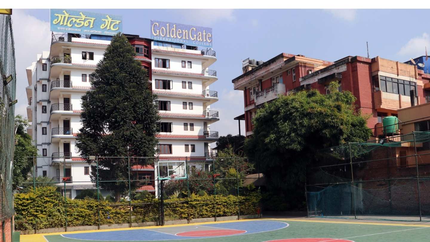
MSc Environmental Science at GoldenGate International College, Battisputali, Kathmandu
MSc Environmental Science at GoldenGate International College in Battisputali, Kathmandu runs under Tribhuvan University’s semester structure. The program studies ecosystems, pollution indicators, environmental chemistry, hydrology, climate processes, geospatial tools, impact assessment, and management practices.
Your learning connects fieldwork, laboratory analysis, policy reading, and research writing so you can turn raw observations into clear, defensible reports.
Highlights
Affiliation: Tribhuvan University
Duration: 2 years (4 semesters)
Academic Area: Ecology, environmental chemistry, hydrology, climatology, GIS/remote sensing, environmental impact assessment (EIA), environmental management, statistics and research methods
Location: Battisputali–Old Baneshwor, Kathmandu
Evaluation: Internal assessments and practical records; TU semester exams, viva, and dissertation/project
Learning Support: Laboratories for water and soil testing, field instruments, GIS lab access, library and e-learning notices
Curriculum Details
Early semesters rebuild foundations across ecology, environmental chemistry, and statistics. Students plan sampling, prepare reagents, and handle instruments for common tests. Seminars train you to read journal articles and summarize methods without jargon.
Middle semesters explore hydrology, watershed processes, air quality, climate variability, and geospatial analysis. GIS tasks include coordinate systems, georeferencing, digitizing, and simple overlays. Field visits link land use, topography, and water bodies to indicator values.
Final semesters move into assessment and management. EIA steps appear through screening, scoping, baseline description, impact prediction, mitigation options, monitoring plans, and report structure. Students complete a dissertation or project that demonstrates question framing, method selection, data analysis, and cautious interpretation.
Objectives
-
Scientific Base: Strengthen understanding of ecological function, chemical indicators, and climate/hydrology links.
-
Applied Measurement: Build safe and repeatable practice for field sampling and laboratory testing.
-
Geospatial Literacy: Use GIS to map features, overlay layers, and support decisions with visuals.
-
Research and Writing: Produce documents that state questions, methods, results, and limits clearly.
-
Professional Conduct: Follow safety, ethics, and documentation norms that withstand review.
Scope
Graduates support environmental assessments, compliance reviews, water and sanitation projects, conservation initiatives, and monitoring roles. Positions involve sampling, analysis, GIS mapping, documentation, and coordination with engineers, planners, and community groups. Students who want deeper research move toward MPhil/PhD or sector training when entry rules fit.
Learning Outcomes
-
Systems Thinking: Explain interactions among land, water, air, and biota using measurable indicators.
-
Indicator Mastery: Interpret pH, conductivity, hardness, turbidity, nutrients, BOD/COD ideas, and coliform counts.
-
Spatial Skills: Prepare base maps, digitize features, and present overlays that match field notes.
-
Assessment Habit: Draft screening notes, terms of reference, and monitoring matrices for a sample assignment.
-
Communication: Write concise summaries with tables, charts, and references that a reviewer can verify.
Skill Development Modules
-
Field Techniques: Site selection, GPS use, transects, quadrats, stream gauging basics, and chain-of-custody logs.
-
Laboratory Techniques: Standard preparations, titrations, colorimetry, gravimetric steps, microbiological indicators, and QA/QC sheets.
-
GIS and Remote Sensing: Projection handling, raster–vector workflows, supervised classification at an introductory level, and map layouts.
-
Statistics and Data: Spreadsheet cleaning, descriptive statistics, confidence intervals, simple hypothesis tests, and regression at a basic level.
-
Reporting: EIA structure, data appendices, citation style, and figure captions that match the numbers.
Teaching Methodology
Teaching uses lecture–discussion, field exercises, laboratory practicals, and GIS labs. Faculty schedule seminars with article critiques and short talks. Internal assessment combines quizzes, lab files, field reports, GIS outputs, and presentations. Final evaluation follows Tribhuvan University semester exams, viva, and dissertation or project review.
Admission Requirements
Eligibility: Bachelor’s degree in Environmental Science or a closely related field that meets TU criteria
Entrance: TU/department or college entrance process as announced for the intake
Selection: Merit ranking, counseling or interview where scheduled, document verification
Documents: Bachelor transcripts, character certificate, recent photos, identification, and equivalence if applicable
Advisory: Applicants from other universities complete equivalence procedures before admission
Career Opportunities
Typical Roles: Environmental analyst, field and lab officer, GIS technician trainee, EIA/IEE documentation assistant, project M&E assistant
Work Settings: Consulting firms, environmental laboratories, water and sanitation projects, conservation programs, local bodies, NGOs/INGOs, and public agencies
Growth Path: Specialist or coordinator roles after experience and training; higher research where entry rules fit
Scholarships and Financial Aid
Categories: Merit by results, entrance performance, inclusion categories, community-school background, and recognized ECA/sports
Renewal: Continuation depends on academic performance and program rules
Tip: Keep transcripts, certificates, and sample outputs (maps, tables, field sheets) ready for scholarship and interview review
Why Choose This Course?
Balanced Coverage: Ecology, chemistry, hydrology, climate, GIS, and assessment connect across four semesters.
Practical Emphasis: Field and lab routines build discipline and confidence in real settings.
Decision Support: Mapping and statistics help you convert observations into clear notes for planners and auditors.
Pathways: The degree supports roles in assessment and monitoring or further study in environmental fields.
Conclusion
MSc Environmental Science at GoldenGate International College trains you to measure, map, and explain environmental change with evidence. Students keep careful field diaries, maintain lab files, and produce maps and charts that stand up in review. Consistent practice and honest reporting shape a profile that serves both project work and research.
FAQ
Is the program under Tribhuvan University?
Yes. The program follows Tribhuvan University’s semester plan.
How long does the course run?
Two years across four semesters.
Does admission include an entrance step?
Yes. Applicants follow the entrance process announced for the intake.
What tools will I learn in GIS labs?
Projection handling, digitizing, overlays, basic classification, and map layouts at an introductory level.
What practicals should I expect?
Water and soil testing, microbial indicators, field gauging basics, and structured EIA documentation tasks.
Can I move to research after graduation?
Yes. Graduates apply for MPhil/PhD or sector training where eligibility and entrance criteria fit.