Konjyosom Rural Municipality is a local level of Lalitpur District under Bagmati Province, Nepal. It was declared by the Government of Nepal on Falgun 22, 2073, after the incorporation of the former Village Development Committees of Chaughare, Shankhu, Dalchoki, Nallu, and Bhardeu.
The rural municipality has five wards and covers 44.16 square kilometers. Located in the hilly central-southern part of Lalitpur District, Konjyosom is known for its agricultural base, Tamang community presence, religious sites, forests, streams, and highland settlements. According to the National Census 2078, its population is 8,989, while the rural municipality survey of 2081 records a population of 11,323 in 2,150 households.
| Field | Details |
|---|---|
| Official Name | Konjyosom Rural Municipality |
| Nepali Name | कोन्ज्योसोम गाउँपालिका |
| District | Lalitpur |
| Province | Bagmati Province |
| Declaration Date | Falgun 22, 2073 |
| Area | 44.16 square kilometers |
| Wards | 5 |
| Population | 8,989 according to National Census 2078 |
| Population Survey | 11,323 according to rural municipality survey of 2081 |
| Households | 2,150 according to rural municipality survey of 2081 |
| Major Ethnic Group | Tamang, 75.78% |
| Main Occupation | Agriculture |
| Elevation Range | 1,033 meters to 2,916 meters above sea level |
| Average Annual Rainfall | 1,610 mm |
Konjyosom Rural Municipality is one of the local levels of Lalitpur District. It is situated in a hilly area and includes settlements with agricultural land, forests, streams, religious sites, and culturally diverse communities.
The rural municipality was formed by merging the former Village Development Committees of Chaughare, Shankhu, Dalchoki, Nallu, and Bhardeu. Its administrative center was designated near the office of the former Chaughare VDC, and five wards were established.
Konjyosom has a strong connection with Magar and Tamang civilizations. The Tamang community is the largest ethnic group, accounting for 75.78% of the rural municipality’s population according to the 2081 rural municipality survey.
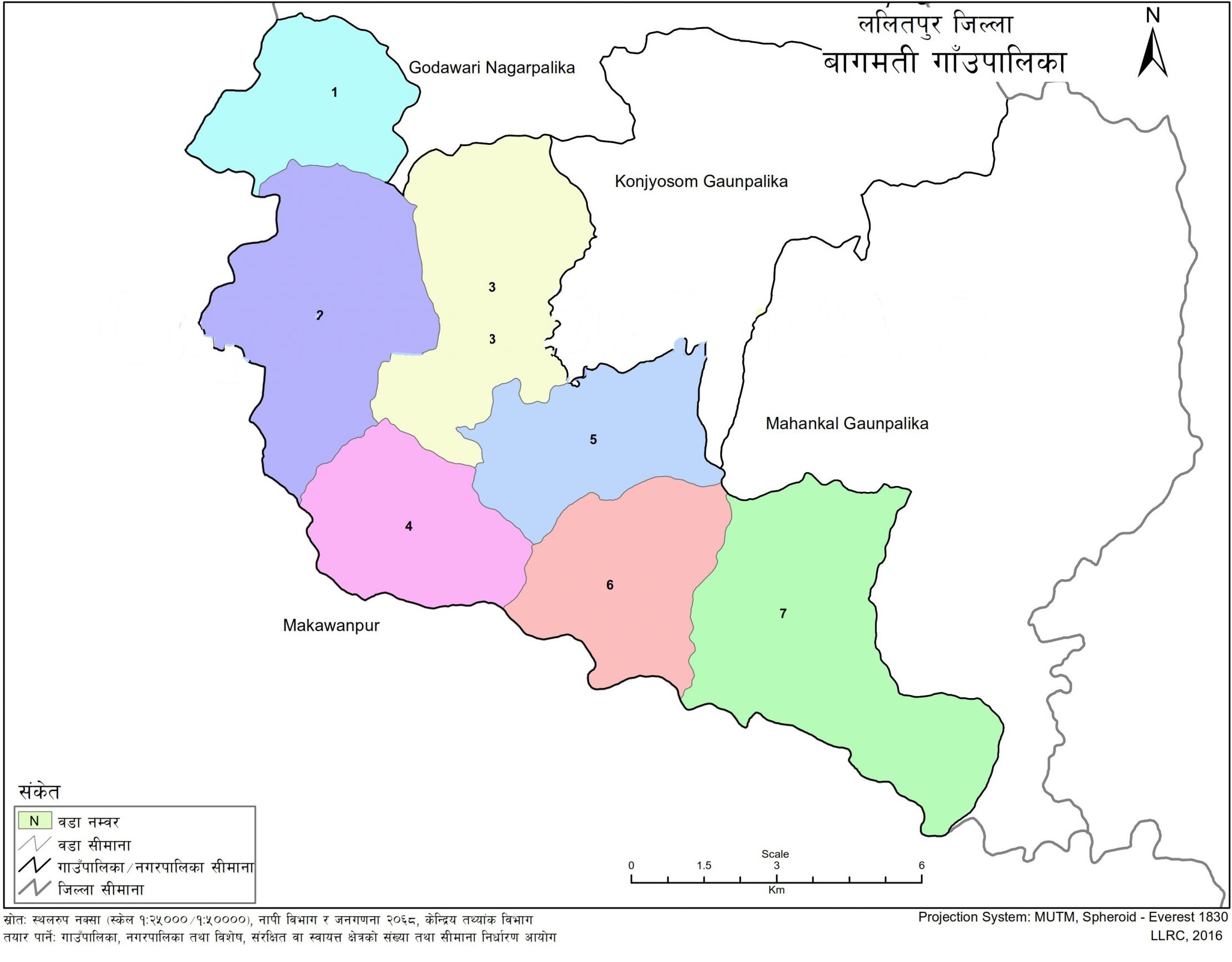
Konjyosom Rural Municipality is located in Lalitpur District under Bagmati Province. Godawari Municipality lies to the north. Godawari Municipality and Bagmati Rural Municipality lie to the west. Bagmati Rural Municipality and Mahankal Rural Municipality lie to the south, while Mahankal Rural Municipality and Kavrepalanchok District lie to the east.
The rural municipality is located in the hilly region of Lalitpur District. It covers an area of 44.16 square kilometers and has an elevation range from 1,033 meters to 2,916 meters above sea level.
Konjyosom Rural Municipality was declared by the Government of Nepal on Falgun 22, 2073. Its formation followed the report recommended by the Commission for Determining the Number and Boundaries of Rural Municipalities, Municipalities, and Special, Protected or Autonomous Areas, formed under Article 295, Sub-article 3 of the Constitution of Nepal.
The rural municipality was formed by incorporating the former VDCs of Chaughare, Shankhu, Dalchoki, Nallu, and Bhardeu. These former VDCs became the basis for the five wards of the rural municipality.
| Ward No. | Area |
|---|---|
| Ward No. 1 | Chaughare |
| Ward No. 2 | Shankhu |
| Ward No. 3 | Dalchoki |
| Ward No. 4 | Nallu |
| Ward No. 5 | Bhardeu |
Each ward corresponds to the former VDC area with former ward numbers 1–9 included within the respective local structure.
Konjyosom Rural Municipality has hills, slopes, forest areas, streams, river corridors, and cultivable valleys. About 31% of the land is described as highly fertile cultivable land. In recent years, land fragmentation has increased due to the impact of urbanization.
The rural municipality has no shortage of forest and watershed areas. Small and large streams and rivers are found within its surroundings. Land near rivers, rivulets, and streams is fertile because of alluvial soil and supports food crops.
The landform includes different slope categories. Some areas have slopes greater than 40 degrees, while several areas in Nallu, Shankhu, and Dalchoki have moderate to steep slopes. Because of slope conditions, weak soil, and sandy soil in some areas, light rainfall can increase the risk of landslides and soil erosion.
Konjyosom Rural Municipality has a temperate climate. Due to geographical diversity, temperate and cool temperate climatic conditions are found in the area.
The average annual humidity remains between 75.0% and 80%. Warm weather is felt from Chaitra to Ashwin. Ashwin, Kartik, and Falgun are considered favorable from a climatic perspective, while Mangsir and Magh are cold months.
The 12-month average temperature is 14.8°C. The average annual rainfall is 1,610 mm. The average maximum temperature is recorded as 28.3°C, while the average minimum temperature is 3.5°C. Another local record notes a maximum temperature of 26.4°C and minimum temperature of 2.3°C.
According to the National Census 2078, Konjyosom Rural Municipality has a total population of 8,989. According to the rural municipality survey of 2081, the population is 11,323, with 2,150 households.
The Tamang community is the largest ethnic group, accounting for 75.78%. People from different ethnic groups, religions, communities, and traditions live in the rural municipality. Most residents follow Buddhism, while Hinduism and Christianity are also present.
Major festivals observed in the rural municipality include Buddha Jayanti, Lhosar, Dashain, Tihar, Maghe Sankranti, Janai Purnima, Saune Sankranti, Teej, Shree Krishna Janmashtami, Dhanya Purnima, Fagu Purnima, Chhath, Jethi Purnima, Asare Purnima, Saune Purnima, and Govardhan Puja.
Agriculture is the main occupation of the people living in Konjyosom Rural Municipality. Agriculture has the largest share in average household income, while foreign employment is another major source of income for residents.
The rural municipality produces crops such as paddy, maize, millet, wheat, barley, mustard, vegetables, peas, gram, soybean, and pulses. Maize is the main crop in most fields. In some places, millet is planted after weeding maize during the rainy season.
Winter crops include millet, buckwheat, wheat, barley, peas, pigeon peas, horse gram, black soybean, gram, lentils, mung beans, maize, naked barley, potatoes, mustard, spices, oilseeds, fine grains, vegetables, and cash crops.
Monsoon crops include paddy, maize, millet, buckwheat, soybean, pulses, fruits, and vegetables. Paddy cultivation is practiced to some extent in Ward No. 4 and Ward No. 5.
Livestock farming is a major occupation in Konjyosom Rural Municipality. Local farmers are involved in cattle, buffalo, goats, pigs, swine, poultry, pigeons, ducks, and related livestock activities.
The rural municipality has potential for commercial livestock farming. Milk collection centers, poultry farming, goat farming, pig farming, fish farming, and cottage industries are identified among local income-generating possibilities.
Konjyosom Rural Municipality has schools from early childhood to secondary and plus-two levels. The institution statistics record 18 schools, including 17 public schools and 1 private school.
| Category | Count |
|---|---|
| Pre-school | 18 |
| Basic | 17 |
| Secondary | 6 |
| Plus-2 | 3 |
| Public | 17 |
| Private | 1 |
| Total Schools | 18 |
Schools in the rural municipality include Baleshwori Secondary School, Gupteshwor Basic School, Gupteshwor Secondary School, Shree Bagh Bhairab Secondary School, Magar Gaun Secondary School, Goth Bhanjayang Secondary School, Kanti Academy English School, Gyanodaya Basic School, Saraswati Secondary School, Devi Basic School, Bhumithumka Basic School, Shree Banaspati Basic School, Mahangkal Basic School, Kali Seti Devi Basic School, Shree Gyanjyoti Basic School, Kali Devi Basic School, Buddha Basic School, and Janahit Basic School.
Konjyosom Rural Municipality has local trade centers across different wards. The main trade centers include:
Bhardeu-2
Panchadhare-5
Gudure-5
Malkhet-5
Chiuri-4
Simbhanjyang-1
Chautara-1
Anand Khel Dhunge-3
Lakuri Bhanjyang-2
Magargaun Majhigaun-3
Gotikhelgaun-3
Shilunge Besi-3
Devithan-4
Watikhoch-4
Madsam-4
Konjyosom Rural Municipality has mining resources such as red soil, stone, gravel, and sand. The rural municipality has a sufficient quantity of such resources.
Extraction and use of mineral resources remain an area requiring better management. Controlled and proper use of local mines can support local employment and improve the local economy.
The rural municipality also faces challenges related to river erosion, uncontrolled extraction of stone, gravel, and sand, and illegal smuggling from forests.
Konjyosom Rural Municipality has religious, cultural, natural, and historical sites. These places are important for local identity and internal tourism.
Gupteshwar Cave is located in Ward No. 4 and is important from religious and tourism perspectives. A large fair is held there on Baisakh Purnima. Residents worship Gupteshwar Mahadev on the day before Baisakh Purnima, followed by the fair on the full moon day.
Kanchhikot Temple is located in Bhardeu and is a goddess temple worshipped by the Tamang community. A fair is held at this temple on Magh 1. Bal Kumari Temple in Dalchoki is another religious site in the rural municipality.
| Site | Ward / Area |
|---|---|
| Gupteshwar Temple | Ward No. 4, Bhardeu |
| Kanchhikot Temple | Ward No. 5, Bhardeu |
| Bal Kumari Temple | Ward No. 3, Dalchoki |
Small temples, monasteries, shrines, chaityas, churches, and other places of worship are also found in different parts of the rural municipality.
Local football grounds and similar open spaces exist in different locations of the rural municipality. Large parks and developed open-area structures have not been recorded within the rural municipality.
Cremation sites are located in various areas, including Lamidanda, Khochgaun, and Jhol Tol in Ward No. 5; Dhungre Sundhara in Ward No. 4; and Bhardeu and Lopsa in Ward No. 3.
Konjyosom Rural Municipality has rivers, rivulets, and streams flowing through different areas. These water sources support livestock watering and irrigation by farmers as needed.
The rural municipality has potential in transport services, information technology, educational training centers, financial services, agriculture, livestock, small industries, and tourism. At the same time, it faces development challenges linked to employment, drinking water management, public toilets, road quality, commercial agriculture, land fragmentation, urbanization, sports open spaces, river erosion, mineral extraction, and forest protection.
For service-related local information, readers may refer to Konjyosom Rural Municipality local government services.
| School Name - Location | Type | Level |
|---|---|---|
| Baleshwori Secondary School - Bhardeu, Konjyosom-5, Lalitpur | Public | Nursery - 12 |
| Gupteshwor Basic School - Pauwachaur, Konjyosom-5, Lalitpur | Public | Nursery - 8 |
| Gupteshwor Secondary School - Nallu, Dungesundarpani, Konjyosom-4, Lalitpur | Public | Nursery - 10 |
| Shree Bagh Bhairab Secondary School - Chaughare, Konjyosom-1, Lalitpur | Public | Nursery - 10 |
| Magar Gaun Secondary School - Sankhu, Manechour, Konjyosom-2, Lalitpur | Public | Nursery - 12 |
| Goth Bhanjayang Secondary School - Dalchoki, Bhattedanda, Konjyosom-3, Lalitpur | Public | Nursery - 12 |
| Kanti Academy English School - Konjyosom, Lalitpur | Private | Nursery - 1 |
| Gyanodaya Basic School - Ghangawa, Chaughare, Konjyosom-1, Lalitpur | Public | Nursery - 8 |
| Saraswati Secondary School - Shyalbhanjyang, Konjyosom-2, Lalitpur | Public | Nursery - 10 |
| Devi Basic School - Konjyosom-4, Lalitpur | Public | Nursery - 8 |
| Bhumithumka Basic School - Bhumithumka, Konjyosom-2, Lalitpur | Public | Nursery - 8 |
| Shree Banaspati Basic School - Sirudada, Konjyosom-1, Lalitpur | Public | Nursery - 5 |
| Mahangkal Basic School - Tallo Nallu, Konjyosom-4, Lalitpur | Public | Nursery - 5 |
| Kali Seti Devi Basic School - Konjyosom-1, Lalitpur | Public | Nursery - 7 |
| Shree Gyanjyoti Basic School - Silengabase, Konjyosom-3, Lalitpur | Public | Nursery - 5 |
| Kali Devi Basic School - Magargaon, Konjyosom-2, Lalitpur | Public | Nursery - 3 |
| Buddha Basic School - Khursanibari, Konjyosom-3, Lalitpur | Public | Nursery - 4 |
| Janahit Basic School - Konjyosom-3, Lalitpur | Public | Nursery - Nursery |
| Category | Count |
|---|---|
| Pre-school | 18 |
| Basic | 17 |
| Secondary | 6 |
| Plus-2 | 3 |
| Public | 17 |
| Private | 1 |
| Total | 18 |
Konjyosom Rural Municipality is located in Lalitpur District under Bagmati Province, Nepal.
Konjyosom Rural Municipality was declared by the Government of Nepal on Falgun 22, 2073.
The rural municipality was formed by incorporating the former VDCs of Chaughare, Shankhu, Dalchoki, Nallu, and Bhardeu.
There are five wards in Konjyosom Rural Municipality.
Konjyosom Rural Municipality covers an area of 44.16 square kilometers.
Agriculture is the main occupation of residents in Konjyosom Rural Municipality.
According to the National Census 2078, the population is 8,989. According to the rural municipality survey of 2081, the population is 11,323.
The main religious sites include Gupteshwar Temple in Ward No. 4, Kanchhikot Temple in Ward No. 5, and Bal Kumari Temple in Ward No. 3.

.jpg)