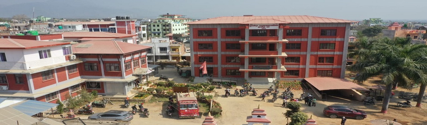
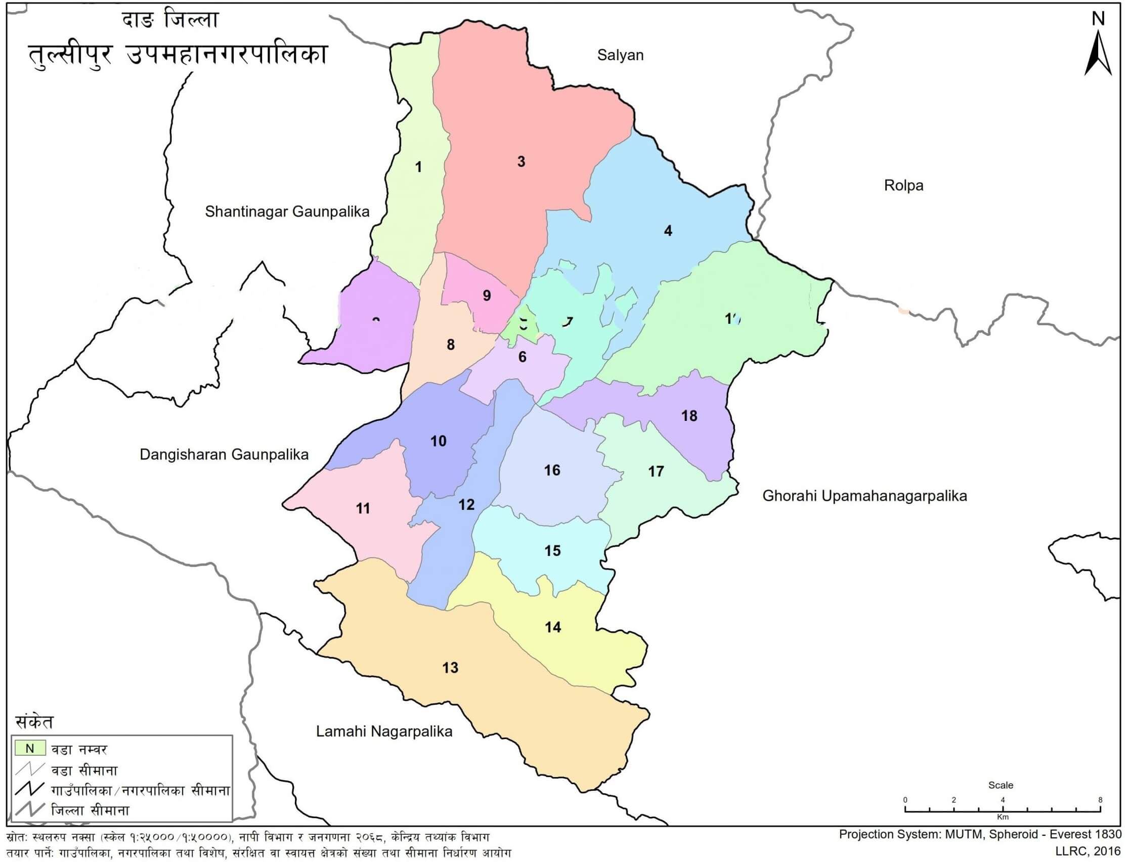
Local Government Services at Tulsipur Sub-Metropolitan City cover administrative, social, development, and public service functions at the local level. Tulsipur Sub-Metropolitan City is located in Dang District in the western region of Nepal and has 19 wards across 384.63 square km.
The service scope includes local level development projects, education, health and population, youth and sports, social security, vital registration, urban planning, tax collection, transportation, communication and information technology, agriculture and livestock development, forestry, water resource and irrigation, local resource use, land registration, and social welfare distribution.
| Particular | Detail |
|---|---|
| Service Area | Local Government Services |
| Local Level | Tulsipur Sub-Metropolitan City |
| Nepali Name | तुलसीपुर उपमहानगरपालिका |
| District | Dang |
| Establishment Date | 2073/09/22 |
| Number of Wards | 19 |
| Area | 384.63 square km |
| Population | 149,647 |
| Households | 34,978 |
| Literacy Rate | 96.5% |
Tulsipur Sub-Metropolitan City provides local government services through its administrative structure and ward-level system. The service areas include public administration, local development, social services, education, health, agriculture, infrastructure, records, taxation, and resource management.
The city’s local service responsibilities are connected with its population, households, wards, settlements, institutions, transport points, health facilities, schools, land use pattern, and natural resources.
Tulsipur Sub-Metropolitan City has 19 wards. Ward-level service delivery supports residents in accessing local administrative services and basic public records.
Key service areas include:
Local administrative services
Ward-level public service coordination
Local level development projects
Vital registration
Social security-related services
Social welfare distribution
Vital registration includes birth, death, marriage, migration, and divorce registration.
Tulsipur provides local level development services connected with planning, infrastructure, public facilities, and settlement management.
The city has both plain and hilly terrain, with about 30 percent of its area lying in the flat land of Dang Valley. Its land use includes forest, shrubland, riverbank and riverbed, settled area, and barren or rocky land.
Urban planning and local development services are relevant to settlement areas, public facilities, roads, transport access, and municipal infrastructure.
Education services at the local level cover basic and secondary education. Tulsipur has community schools, institutional schools, technical schools, campuses, and a polytechnic institute.
| Institution Type | Number |
|---|---|
| University | 1 |
| Community campuses | 2 |
| Institutional campuses | 4 |
| Community schools | 83 |
| Institutional schools | 72 |
| Polytechnic institute | 1 |
| Technical schools | 7 |
School-level data includes pre-school, basic, secondary, and plus-two levels.
| Level | Grade | Number of Schools |
|---|---|---|
| Pre-school | ECD | 146 |
| Basic | Grades 1–8 | 135 |
| Secondary | Grades 9–12 | 84 |
| +2 | Grades 11–12 | 24 |
Health and population services are part of local public service delivery in Tulsipur. The city has hospitals, health posts, birthing centers, municipal health centers, community health units, clinics, vaccination centers, laboratories, and pharmacies.
| Health Institution Type | Number |
|---|---|
| Provincial hospital | 1 |
| Provincial Ayurveda hospital | 1 |
| Corona special hospital | 1 temporary |
| Health posts | 8 |
| Birthing centers | 6 |
| Urban health promotion center | 1 |
| Municipal health centers | 11 |
| Community health units | 2 |
| Village clinics | 26 |
| Vaccination centers | 51 |
| Ayurveda dispensary | 1 |
| Community hospital eye hospital | 1 |
| Private hospitals | 3 |
| Polyclinics | 8 |
| Clinics | 6 |
| Diagnostic centers | 2 |
| Laboratories | 8 |
| Pharmacies | 55 |
Agriculture and livestock development are part of the local service scope. Tulsipur has 172.12 hectares of cultivable land and 152.27 hectares of cultivated land. Year-round irrigation facility covers 15 percent.
Families dependent on agriculture account for 60.5 percent. Water resource and irrigation services are relevant to local agriculture, land use, and river systems.
Main rivers and streams include Babai River, Kala Khola, Patra Khola, Sakram Khola, Hapur Khola, Patu Khola, Gwar Khola, Bhamke Khola, and Tui Khola.
Tulsipur’s land-use pattern includes 154.8 square km of forest and 33.16 square km of shrubland. Local government services related to forestry and local resource use are connected with land management, natural resources, riverbank areas, and community-level development.
| Land Use Category | Area |
|---|---|
| Forest | 154.8 square km |
| Shrubland | 33.16 square km |
| Riverbank and riverbed | 4.87 square km |
| Settled area | 21.1 square km |
| Barren/rocky land | 7.4 square km |
Tulsipur provides local government services related to tax collection, local records, and land registration. These services support local administration, revenue management, and public record-keeping.
The city’s population is 149,647, with 34,978 households. Local records and ward-level services are important for residents, households, property-related processes, and service access.
Youth and sports services are supported by public sports infrastructure in Tulsipur. The city has two stadiums: Beljhundi Stadium and Bhawan Bhandari Stadium.
Playgrounds include Araniko, Tiger Club, Gauri Danda, Gairakhali, Kotya Danda, Balapur, Gairichaur, and other local grounds.
Transportation-related local services are connected with the city’s public access and mobility. Tulsipur has one airport, Tarigaun Airport.
The city is 430 km from Kathmandu, 175 km from Butwal Sub-Metropolitan City, and 125 km from Nepalgunj Sub-Metropolitan City.
Communication and information technology services are included within the local government service scope.
Tulsipur has Class A banks, Class B banks, and cooperative institutions. These institutions support local financial access within the municipality.
| Institution Type | Number |
|---|---|
| Class A banks | 22 |
| Class B banks | 8 |
| Cooperative institutions | 161 |
Among the Class A banks, 3 are government banks and 19 are private banks.
Tulsipur borders Ghorahi Sub-Metropolitan City in the east and Lamahi Municipality in the south.
Its western boundary connects with Shantinagar Rural Municipality and Dangisharan Rural Municipality. The northern side connects with Kapurkot Rural Municipality, Triveni Rural Municipality, and Runtigadhi Rural Municipality.
The services include local level development projects, youth and sports, health and population, education, social security, urban planning, tax collection, transportation, communication and information technology, agriculture and livestock development, vital registration, land registration, and social welfare distribution.
Tulsipur Sub-Metropolitan City has 19 wards.
Vital registration includes birth, death, marriage, migration, and divorce registration.
Yes. Education services include basic and secondary education. The city has community schools, institutional schools, technical schools, campuses, and a polytechnic institute.
Tulsipur has a provincial hospital, provincial Ayurveda hospital, health posts, birthing centers, municipal health centers, community health units, village clinics, vaccination centers, private hospitals, clinics, laboratories, and pharmacies.
Tulsipur has 172.12 hectares of cultivable land, 152.27 hectares of cultivated land, 15 percent year-round irrigation facility, and 60.5 percent of families dependent on agriculture.
Tarigaun Airport is located in Tulsipur.



.jpg)